- The capital of Buryatia. The Ulan-Ude

Содержание
- 2. History The beginning is connected with the Cossack winter hut, which was built to collect yasak
- 3. History By the beginning of the twentieth century, about thirty educational institutions worked in the city,
- 4. Сlimate Ulan Ude has a extra continental climate. There have been times when in January the
- 5. Ulan-Ude city is divided into 3 city districts Sovetsky district Zheleznodorozhny district Oktyabrsky district
- 6. Sovetsky district Area 92 sq. Km Population about 93 000 The Sovietsky district is located in
- 7. Zheleznodorozhny district Area 142 sq. Km Population about 142 000 Zheleznodorozhny district is located in the
- 8. Oktyabrsky district Area 203 sq. Km Population about 204 000 The Oktyabrsky district is located in
- 9. Attractions Datsan Rinpoche Bagsha Ethnographic Museum of the Peoples of Transbaikalia The face of the Goddess
- 11. Скачать презентацию
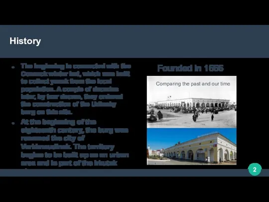
History
The beginning is connected with the Cossack winter hut, which was
History
The beginning is connected with the Cossack winter hut, which was
History
By the beginning of the twentieth century, about thirty educational institutions
History
By the beginning of the twentieth century, about thirty educational institutions
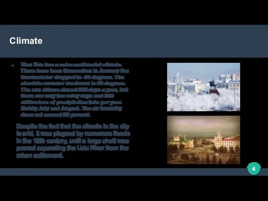
Сlimate
Ulan Ude has a extra continental climate. There have been times
Сlimate
Ulan Ude has a extra continental climate. There have been times
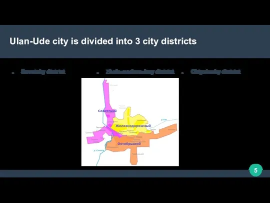
Ulan-Ude city is divided into 3 city districts
Sovetsky district
Zheleznodorozhny district
Oktyabrsky district
Ulan-Ude city is divided into 3 city districts
Sovetsky district
Zheleznodorozhny district
Oktyabrsky district

Sovetsky district
Area 92 sq. Km
Population about 93 000
The Sovietsky district is
Sovetsky district
Area 92 sq. Km
Population about 93 000
The Sovietsky district is
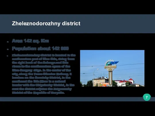
Zheleznodorozhny district
Area 142 sq. Km
Population about 142 000
Zheleznodorozhny district is located
Zheleznodorozhny district
Area 142 sq. Km
Population about 142 000
Zheleznodorozhny district is located
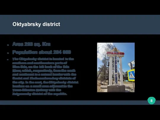
Oktyabrsky district
Area 203 sq. Km
Population about 204 000
The Oktyabrsky district is
Oktyabrsky district
Area 203 sq. Km
Population about 204 000
The Oktyabrsky district is
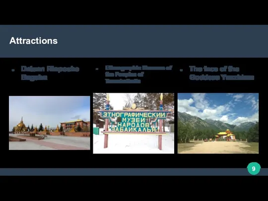
Attractions
Datsan Rinpoche Bagsha
Ethnographic Museum of the Peoples of Transbaikalia
The face of
Attractions
Datsan Rinpoche Bagsha
Ethnographic Museum of the Peoples of Transbaikalia
The face of
 Земля чукотская.... Земля чукотская такая - Как только первый луч скользнет, Вокруг все сразу оживает, Местами тундра зацветает,
 Реки
Реки Отто Юльевич Шмидт: экспедиция в Арктику
 Ветры Земли
 Здравствуй, лес, дремучий лес, Полный сказок и чудес! Ты о чём шумишь листвою Ночью тёмной, грозовою? Что там шепчешь на
  Основные формы рельефа 6 класс - презентация к уроку Географии_
 Что я знаю о крае?
 Природные достопримечательности Румынии
 Туристичні ресурси Західної України
 Географические координаты
 Федеративна Республiка Німеччина
 Amazing Australia
 Презентация на тему Македония
  Волжская Венеция. Балаково
 Перепись населения
 Заповедник Галичья гора
 Караганда – мой любимый город
 Развитие форм рельефа
 Подорож до Австралії
 Картография. Методы картографирования
 Великий Новгород И на левом берегу и правом Стали храмы чудом златоглавым….
 Азовское море - презентация к уроку Географии
 Государство Мадагаскар
 Абхазия - страна души
 Родной город - Иркутск! - презентация к уроку Географии
 Политическая карта мира
 Презентация по географии Украина
  ЮАР - презентация к уроку Географии