- Geography of UK and Northern Irelands. Geography of USA

Содержание
- 2. Geography of United Kingdoom and Northern Island .Geography of USA.
- 3. United Kingdom Official Name: United Kingdom of Great Britain and Northern Ireland
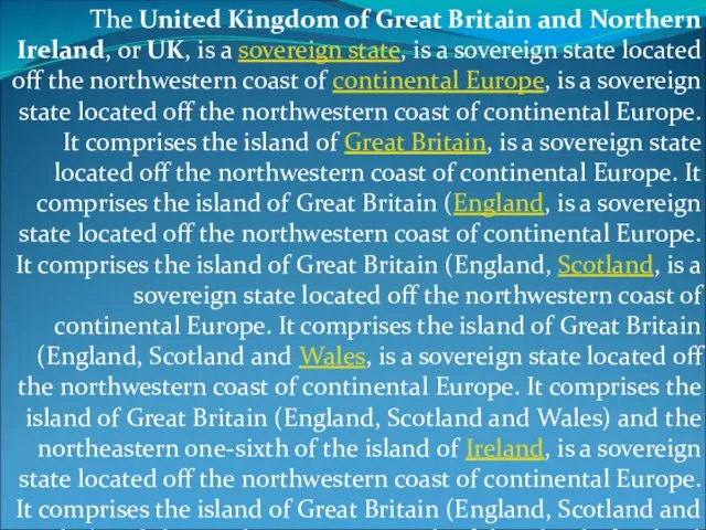
- 4. The United Kingdom of Great Britain and Northern Ireland, or UK, is a sovereign state, is
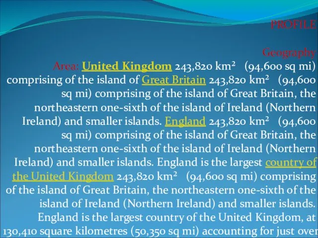
- 5. PROFILE Geography Area: United Kingdom 243,820 km² (94,600 sq mi) comprising of the island of Great
- 6. Cities: Capital--London (metropolitan pop. about 7.56 million). Other cities--Birmingham, Glasgow, Leeds, Sheffield, Liverpool, Bradford, Manchester, Edinburgh,
- 7. The area of the countries of the United Kingdom is set out in the table below.
- 9. People Nationality: Noun--Briton(s). Adjective--British. Population (2010 est.): 62.2 million. Annual population growth rate (2010 est.): 0.7%.
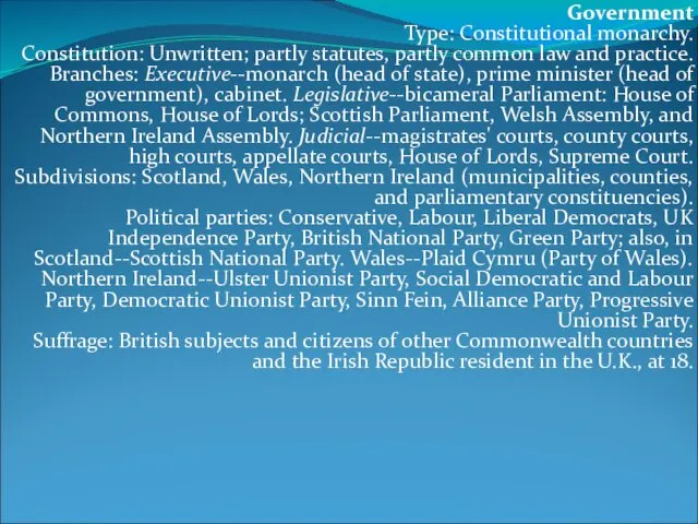
- 10. Government Type: Constitutional monarchy. Constitution: Unwritten; partly statutes, partly common law and practice. Branches: Executive--monarch (head
- 11. Economy GDP (at current market prices, 2009): $2.184 trillion. Annual growth rate (2009): -4.8%. Per capita
- 12. Mountains and hills:- Mountains of the United Kingdom The ten tallest mountains in the UK are
- 13. Rivers and lakes Main articles List of lakes in the United Kingdom; Rivers of the United
- 14. Artificial waterways Waterways in the United KingdomWaterways in the United Kingdom, Canals of Great BritainWaterways in
- 15. Natural resources AgricultureAgriculture is intensiveAgriculture is intensive, highly mechanisedAgriculture is intensive, highly mechanised, and efficient by
- 16. The United States Physical Geography
- 19. The United StatesThe United States is a countryThe United States is a country in the Western
- 20. Area:- From 1989 through 1996, the total area of the US was listed as 9,372,610 km2
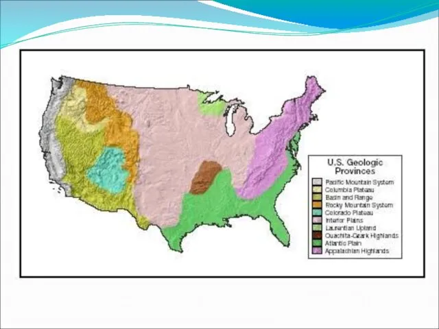
- 21. Landforms The U.S. and Canada have several major mountain ranges: The Rocky Mountains The Appalachian Mountains
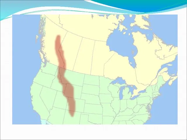
- 22. The Rocky Mountains The Rocky Mountains extend about 3,000 miles from Alaska south to New Mexico.
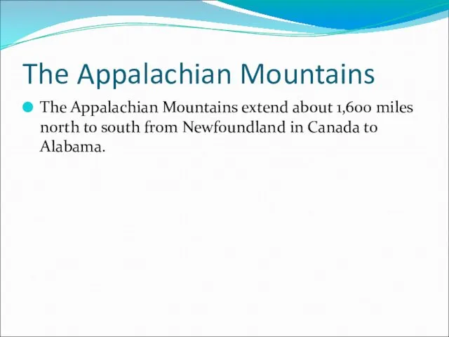
- 24. The Appalachian Mountains The Appalachian Mountains extend about 1,600 miles north to south from Newfoundland in
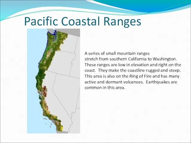
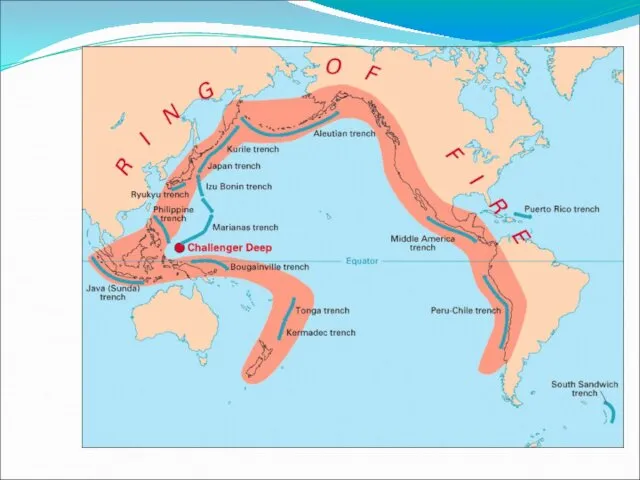
- 25. Pacific Coastal Ranges A series of small mountain ranges stretch from southern California to Washington. These
- 27. Other Landforms The Canadian Shield Interior Lowlands Atlantic and Gulf Coastal Plains Basin and Range Great
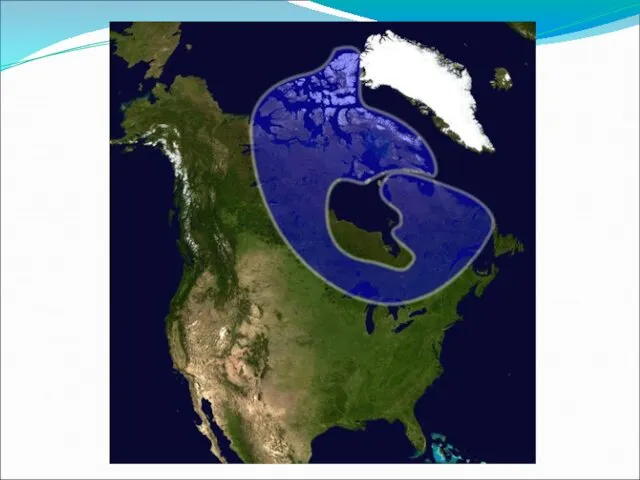
- 28. Canadian Shield The Canadian Shield is a rocky, mainly flat area around Hudson Bay.
- 30. Interior Lowlands An area that spreads from the Appalachian Mountains to the Mississippi River. This area
- 31. Arctic and Gulf Coastal Plains These are flat areas that stretch along the Gulf of Mexico
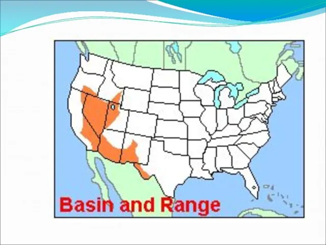
- 32. Basin and Range This area is mostly in Nevada and it consists of rocky outcroppings of
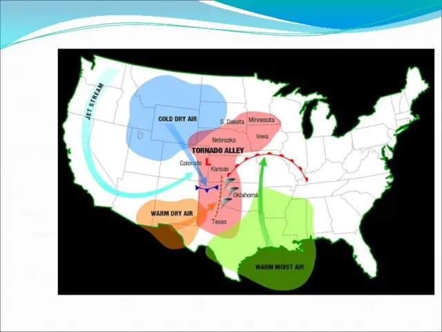
- 34. Great Plains A largely treeless flat area that extends from Canada down to Mexico. The soil
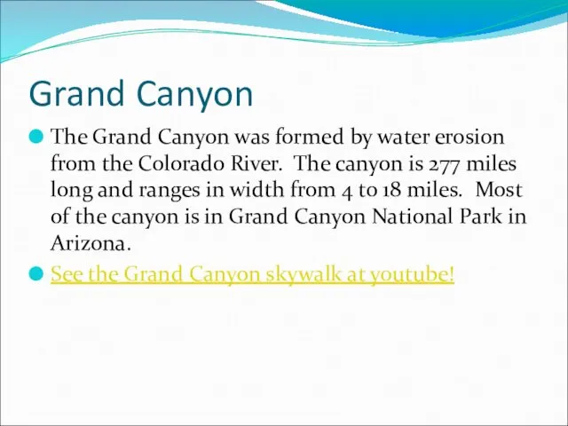
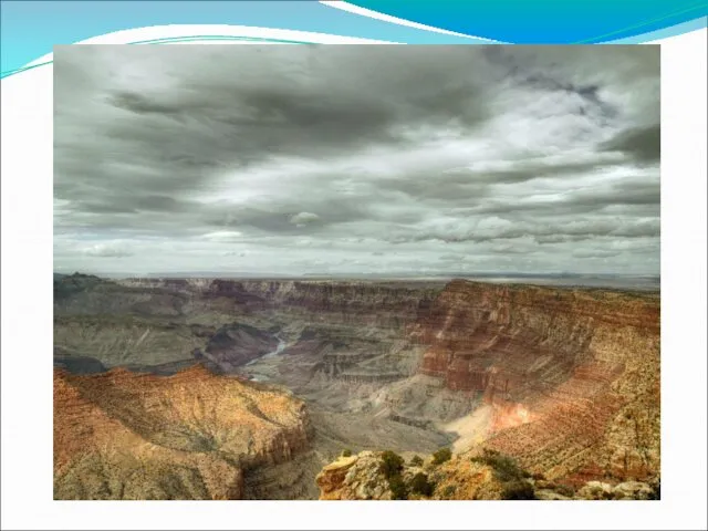
- 36. Grand Canyon The Grand Canyon was formed by water erosion from the Colorado River. The canyon
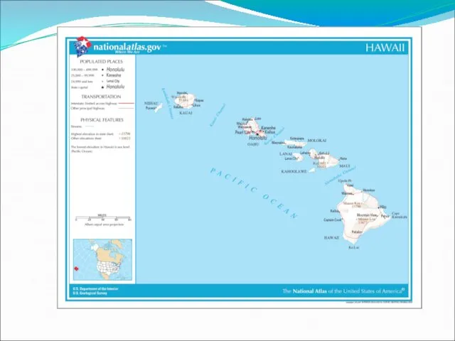
- 38. Groups of Islands Hawaiian archipelago - A group of 19 islands and islets in the Pacific
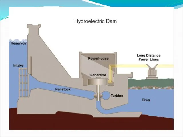
- 41. Rivers Some major rivers in the United States are: Mississippi St. Lawrence Colorado Columbia Rio Grande
- 42. Mississippi River The Mississippi River is the second longest river in the United States with a
- 44. St. Lawrence River The St. Lawrence River connects the Great Lakes to the Atlantic Ocean. The
- 48. Colorado River The Colorado River flows from Colorado to the Gulf of California. The river formed
- 52. Other Water Features Some other important water features are: Gulf of Mexico Great Lakes Arctic Ocean
- 53. Climate Canada and the United States are in the middle and high latitudes. The most common
- 54. Climate Most of the Eastern United States is humid subtropical. This climate zone has a mild
- 55. The tundra is a flat treeless plain with lichens, shrubs, and some flowers.
- 57. Скачать презентацию
Geography of United Kingdoom and Northern Island .Geography of USA.
Geography of United Kingdoom and Northern Island .Geography of USA.
United Kingdom
Official Name:
United Kingdom of Great Britain and Northern
United Kingdom
Official Name:
United Kingdom of Great Britain and Northern
The United Kingdom of Great Britain and Northern Ireland, or UK,
The United Kingdom of Great Britain and Northern Ireland, or UK,
PROFILE
Geography
Area: United Kingdom 243,820 km² (94,600 sq mi) comprising of the island of
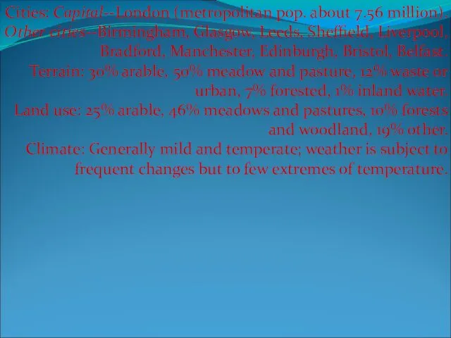
Cities: Capital--London (metropolitan pop. about 7.56 million). Other cities--Birmingham, Glasgow, Leeds,
Cities: Capital--London (metropolitan pop. about 7.56 million). Other cities--Birmingham, Glasgow, Leeds,
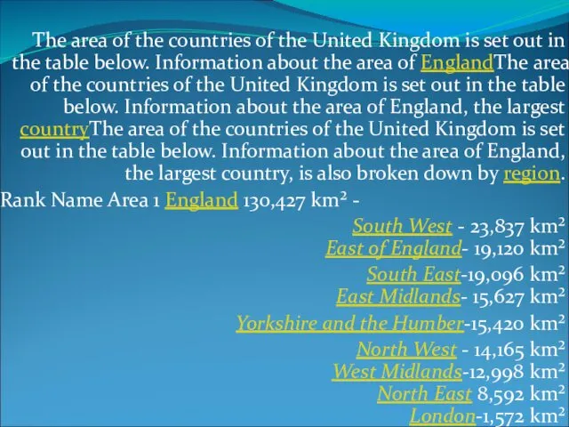
The area of the countries of the United Kingdom is set

People
Nationality: Noun--Briton(s). Adjective--British.
Population (2010 est.): 62.2 million.
Annual population growth rate (2010
People Nationality: Noun--Briton(s). Adjective--British. Population (2010 est.): 62.2 million. Annual population growth rate (2010
Government
Type: Constitutional monarchy.
Constitution: Unwritten; partly statutes, partly common law and
Government Type: Constitutional monarchy. Constitution: Unwritten; partly statutes, partly common law and
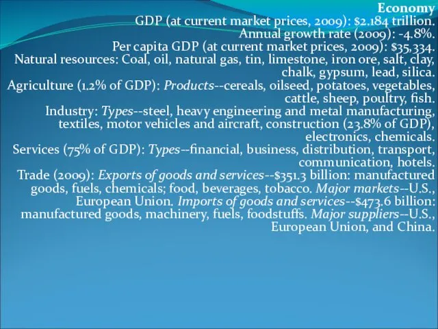
Economy
GDP (at current market prices, 2009): $2.184 trillion.
Annual growth rate
Economy GDP (at current market prices, 2009): $2.184 trillion. Annual growth rate
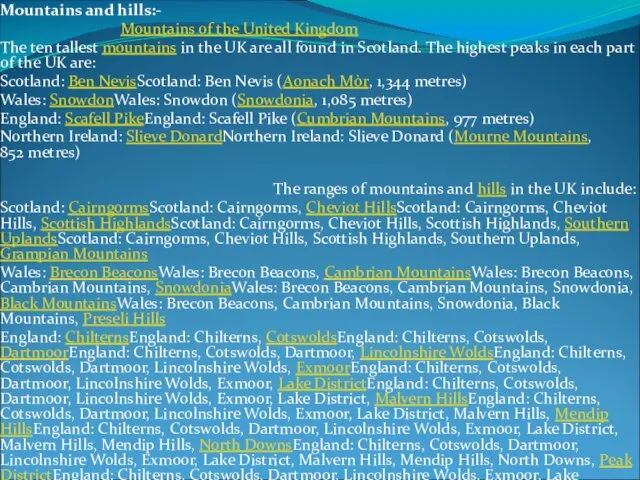
Mountains and hills:-
Mountains of the United Kingdom
The ten tallest mountains
Mountains and hills:-
Mountains of the United Kingdom
The ten tallest mountains
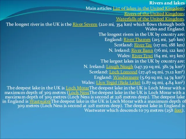
Rivers and lakes
Main articles List of lakes in the United Kingdom;
Rivers
Rivers and lakes
Main articles List of lakes in the United Kingdom;
Rivers
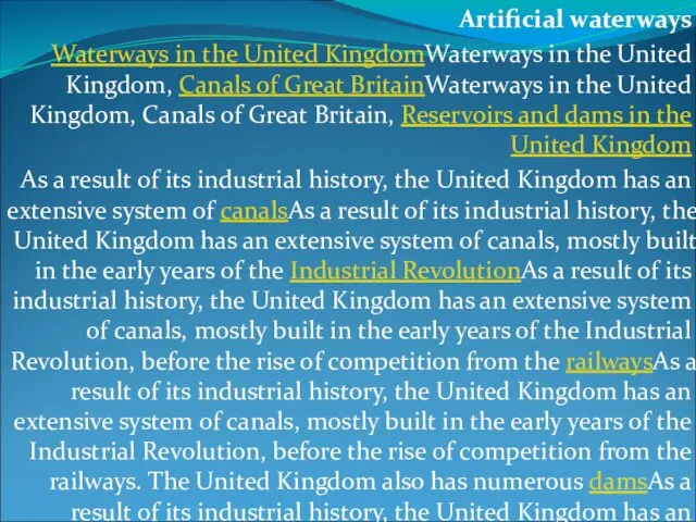
Artificial waterways
Waterways in the United KingdomWaterways in the United Kingdom, Canals
Artificial waterways
Waterways in the United KingdomWaterways in the United Kingdom, Canals
Natural resources
AgricultureAgriculture is intensiveAgriculture is intensive, highly mechanisedAgriculture is intensive, highly
Natural resources
AgricultureAgriculture is intensiveAgriculture is intensive, highly mechanisedAgriculture is intensive, highly
The United States
Physical Geography
The United States
Physical Geography
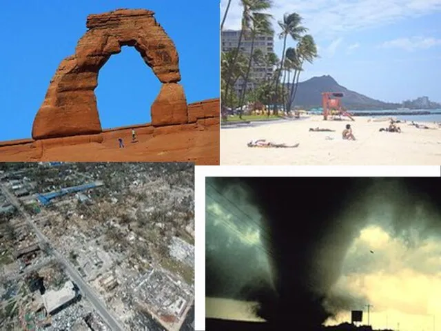
The United StatesThe United States is a countryThe United States is
The United StatesThe United States is a countryThe United States is
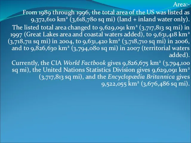
Area:-
From 1989 through 1996, the total area of the US was
Area:-
From 1989 through 1996, the total area of the US was
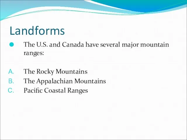
Landforms
The U.S. and Canada have several major mountain ranges:
The Rocky Mountains
The
Landforms
The U.S. and Canada have several major mountain ranges:
The Rocky Mountains
The
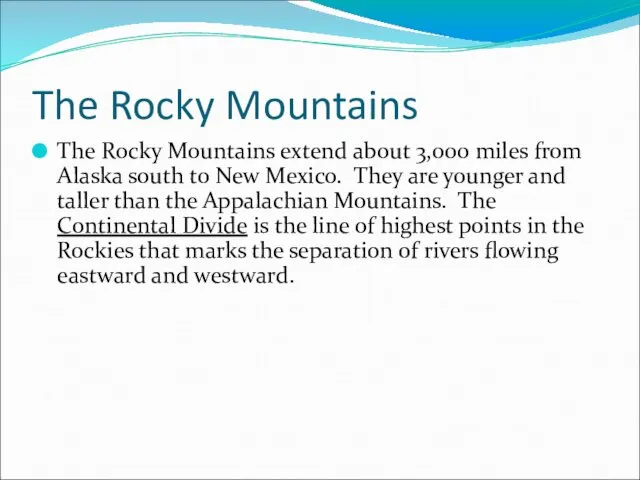
The Rocky Mountains
The Rocky Mountains extend about 3,000 miles from Alaska
The Rocky Mountains
The Rocky Mountains extend about 3,000 miles from Alaska
The Appalachian Mountains
The Appalachian Mountains extend about 1,600 miles north to
The Appalachian Mountains
The Appalachian Mountains extend about 1,600 miles north to
Pacific Coastal Ranges
A series of small mountain ranges
stretch from southern California
Pacific Coastal Ranges
A series of small mountain ranges
stretch from southern California
Other Landforms
The Canadian Shield
Interior Lowlands
Atlantic and Gulf Coastal Plains
Basin and Range
Great
Other Landforms
The Canadian Shield
Interior Lowlands
Atlantic and Gulf Coastal Plains
Basin and Range
Great
Canadian Shield
The Canadian Shield is a rocky, mainly flat area around
Canadian Shield
The Canadian Shield is a rocky, mainly flat area around
Interior Lowlands
An area that spreads from the Appalachian Mountains to the
Interior Lowlands
An area that spreads from the Appalachian Mountains to the
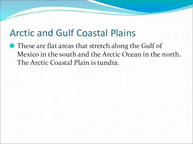
Arctic and Gulf Coastal Plains
These are flat areas that stretch along
Arctic and Gulf Coastal Plains
These are flat areas that stretch along
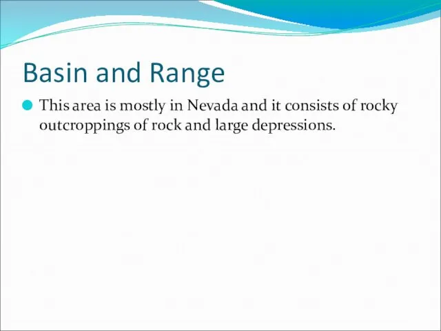
Basin and Range
This area is mostly in Nevada and it consists
Basin and Range
This area is mostly in Nevada and it consists
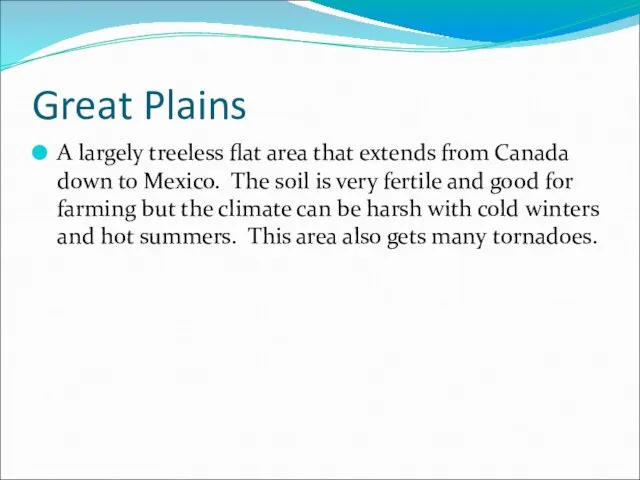
Great Plains
A largely treeless flat area that extends from Canada down
Great Plains
A largely treeless flat area that extends from Canada down
Grand Canyon
The Grand Canyon was formed by water erosion from the
Grand Canyon
The Grand Canyon was formed by water erosion from the
Groups of Islands
Hawaiian archipelago - A group of 19 islands and
Groups of Islands
Hawaiian archipelago - A group of 19 islands and
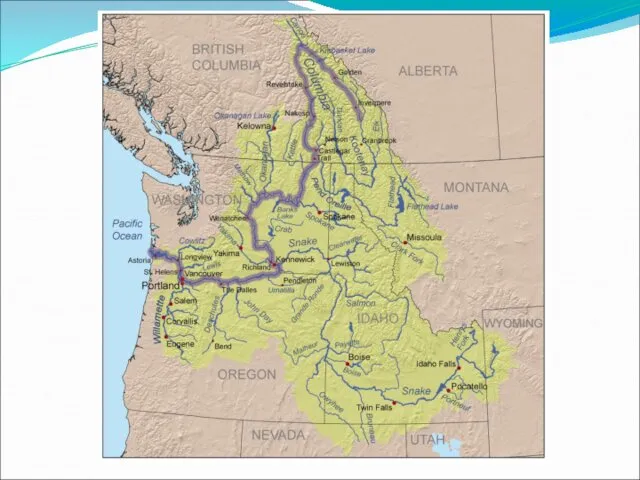
Rivers
Some major rivers in the United States are:
Mississippi
St. Lawrence
Colorado
Columbia
Rio Grande
Rivers
Some major rivers in the United States are:
Mississippi
St. Lawrence
Colorado
Columbia
Rio Grande
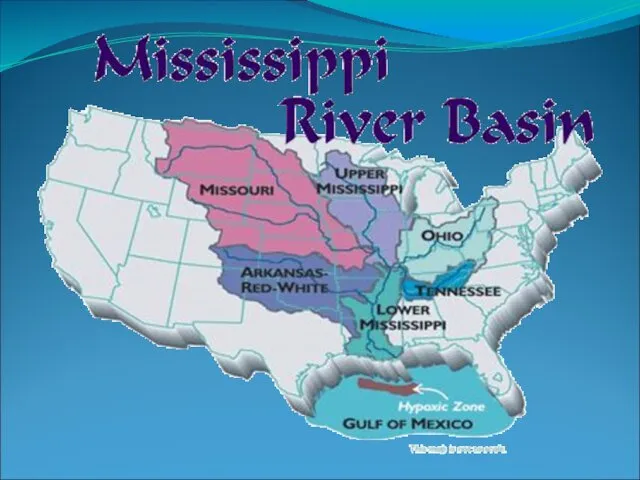
Mississippi River
The Mississippi River is the second longest river in the
Mississippi River
The Mississippi River is the second longest river in the
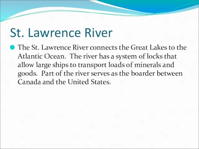
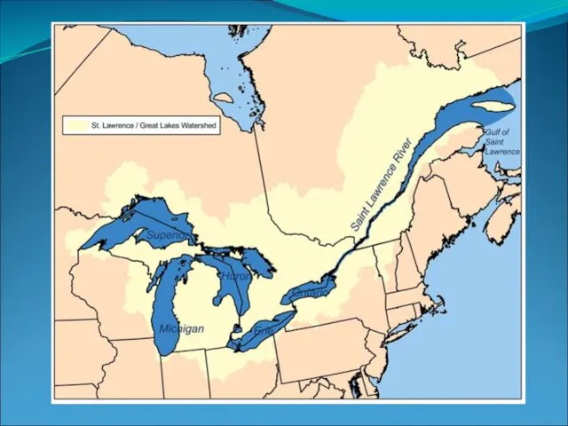
St. Lawrence River
The St. Lawrence River connects the Great Lakes to
St. Lawrence River
The St. Lawrence River connects the Great Lakes to
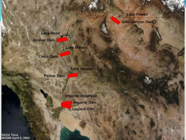
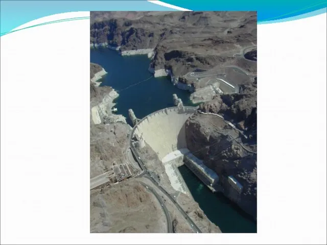
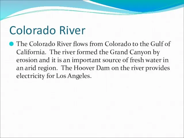
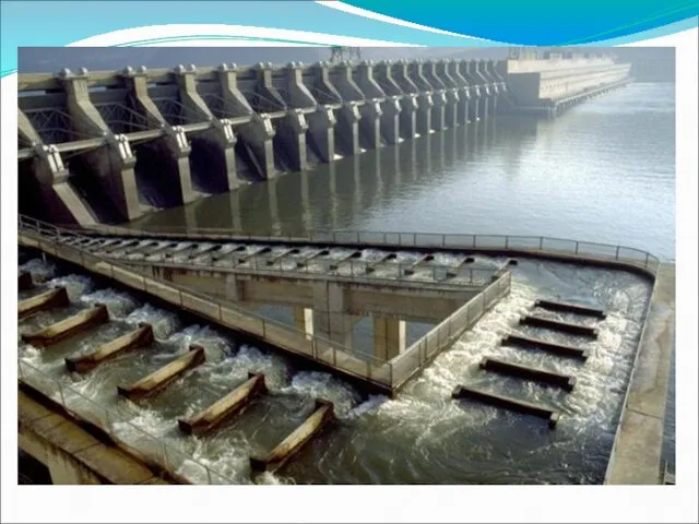
Colorado River
The Colorado River flows from Colorado to the Gulf of
Colorado River
The Colorado River flows from Colorado to the Gulf of
Other Water Features
Some other important water features are:
Gulf of Mexico
Great Lakes
Arctic
Other Water Features
Some other important water features are:
Gulf of Mexico
Great Lakes
Arctic
Climate
Canada and the United States are in the middle and high
Climate
Canada and the United States are in the middle and high
Climate
Most of the Eastern United States is humid subtropical. This climate
Climate
Most of the Eastern United States is humid subtropical. This climate
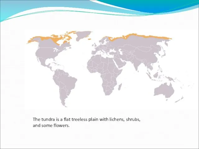
The tundra is a flat treeless plain with lichens, shrubs,
and some
The tundra is a flat treeless plain with lichens, shrubs,
and some
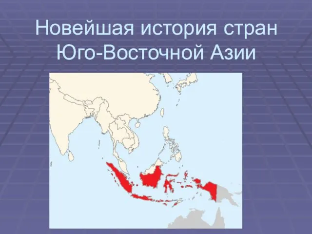 Новейшая история стран Юго-Восточной Азии
 Океания
 Выполнила ученица 10в класса Дубровская Юлия.
 Расизм и национализм – это тупиковая ветвь эволюции
 Смешанные леса
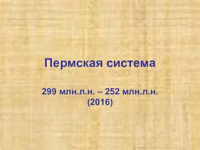 Пермская система. Характеристика периода. (Лекция 13)
 Исследования Мирового океана. Задачи и возможности
 Народы, языки и религии География 7 класс
 Франция
 Литосфера. Обучающий урок
 Природа Европейского Севера
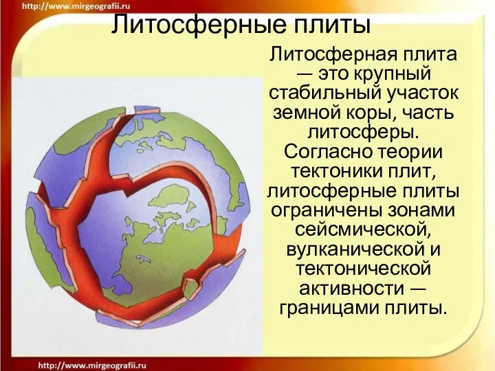 Литосферные плиты Литосферная плита — это крупный стабильный участок земной коры, часть литосферы. Согласно теории тектоники
  Достопримечательности Крыма
 Кругосветные путешествия
 Doing Business in the United Arab Emirates 2012 Mierta Capaul & Aikaterini Leris
 Тайны бермудского треугольника Выполнила: ученица 11 «А» класса МБОУ СОШ №99 Бочарова Лилия Александровна Научный руководител
 Физико-географическая характеристика Азербайджана
 Градусная сеть. Географические координаты
 Зелёный луч
 Реки в природе и на географических картах
 Физико-географическая характеристика Грузии
 Otradnoe. The location on the map
 Южная Америка
 Знатоки географии 10,11 классы - презентация к уроку Географии
 Форма и размеры Земли. Географическая карта. 6-й класс - презентация к уроку Географии
 Инновационные технологии в ТЭК и ЖКХ. Опыт и перспективы - презентация к уроку Географии
 Как люди заселяли Землю
 Вулканы