- Profile leveling

Содержание
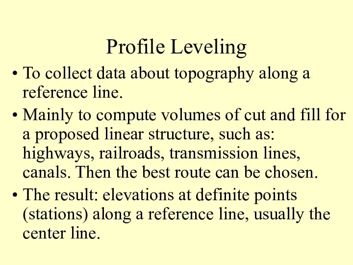
- 2. Profile Leveling To collect data about topography along a reference line. Mainly to compute volumes of
- 3. Staking and Stationing the Reference Line First, topography is studied, a center line is chosen. Second,
- 4. For example station K is (10+24.5) = 1024.5ft from a certain zero, may not exist. First
- 5. First a backsight at a BM is observed. Then, a number of intermediate foresights are observed
- 6. Figure 5.11 Profile leveling. Figure 5-11 Profile Leveling
- 7. Elevation computation: Elevation of line of sight (LS) = EBM + BSBM. Elevation of any intermediate
- 8. BS IS IS IS FS BS FS 1 2 3 4 5 6 A LEVELING PROCESS
- 9. Example: Compute the elevations of points 1 through 5 if the elevation of the BM is
- 10. Answer = 2.11 + 22.13 24.24 = 24.24 – 1.14 23.40 = 24.24 – 0.95 23.10
- 12. Drawing and Using Profiles Drawn using a software now.The following is for reference only, will not
- 14. Скачать презентацию
Profile Leveling
To collect data about topography along a reference line.
Mainly to
Profile Leveling
To collect data about topography along a reference line.
Mainly to
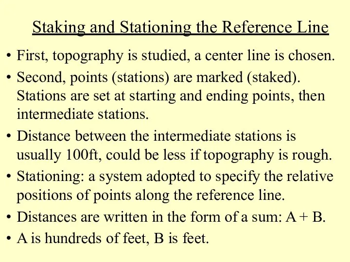
Staking and Stationing the Reference Line
First, topography is studied, a
Staking and Stationing the Reference Line
First, topography is studied, a
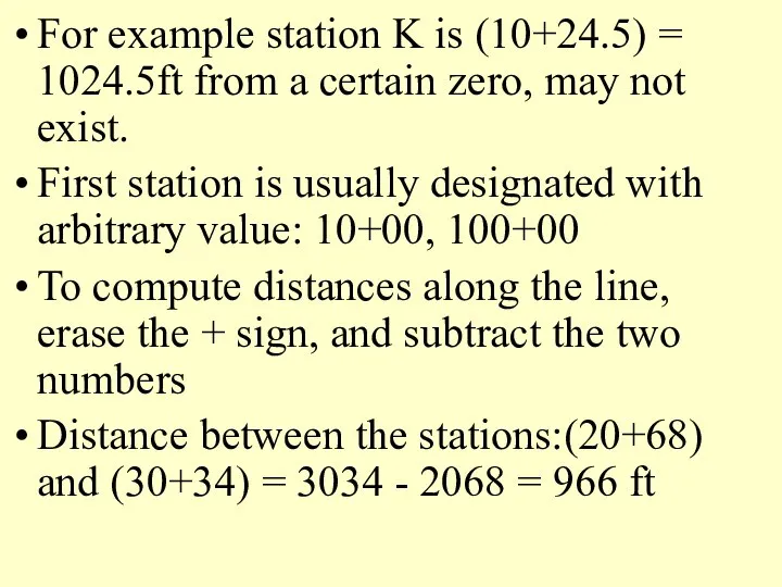
For example station K is (10+24.5) = 1024.5ft from a certain
For example station K is (10+24.5) = 1024.5ft from a certain
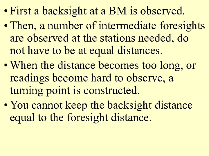
First a backsight at a BM is observed.
Then, a number of
First a backsight at a BM is observed.
Then, a number of
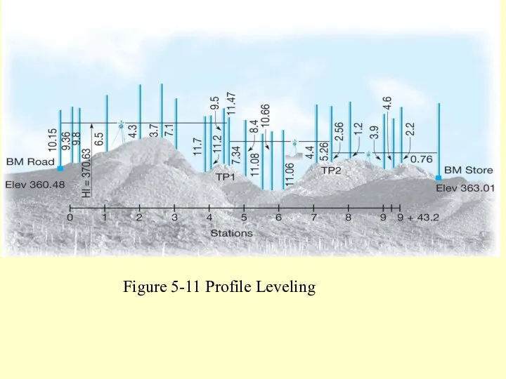
Figure 5.11 Profile leveling.
Figure 5-11 Profile Leveling
Figure 5.11 Profile leveling.
Figure 5-11 Profile Leveling
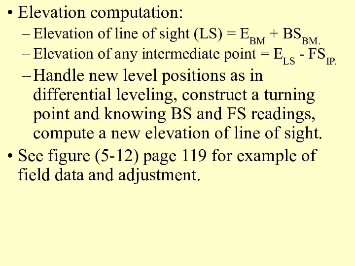
Elevation computation:
Elevation of line of sight (LS) = EBM + BSBM.
Elevation
Elevation computation:
Elevation of line of sight (LS) = EBM + BSBM.
Elevation
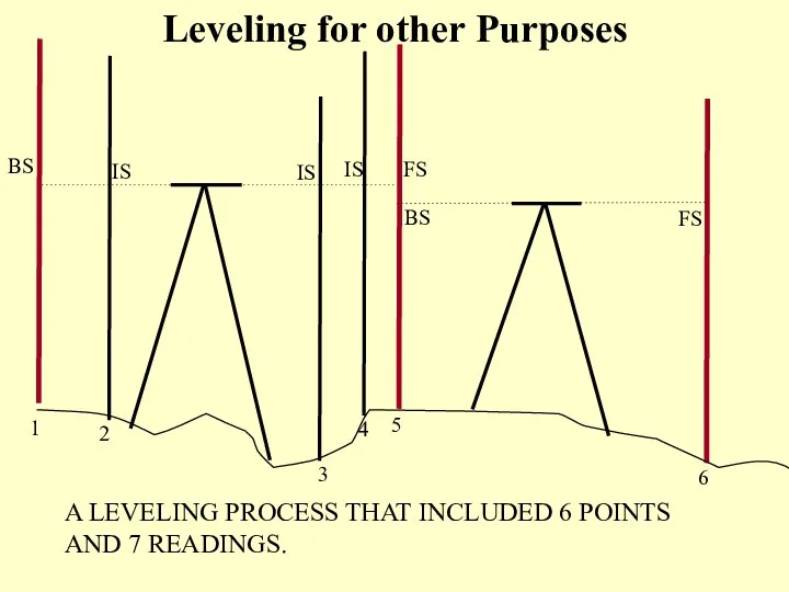
BS
IS
IS
IS
FS
BS
FS
1
2
3
4
5
6
A LEVELING PROCESS THAT INCLUDED 6 POINTS AND 7 READINGS.
Leveling for
BS
IS
IS
IS
FS
BS
FS
1
2
3
4
5
6
A LEVELING PROCESS THAT INCLUDED 6 POINTS AND 7 READINGS.
Leveling for
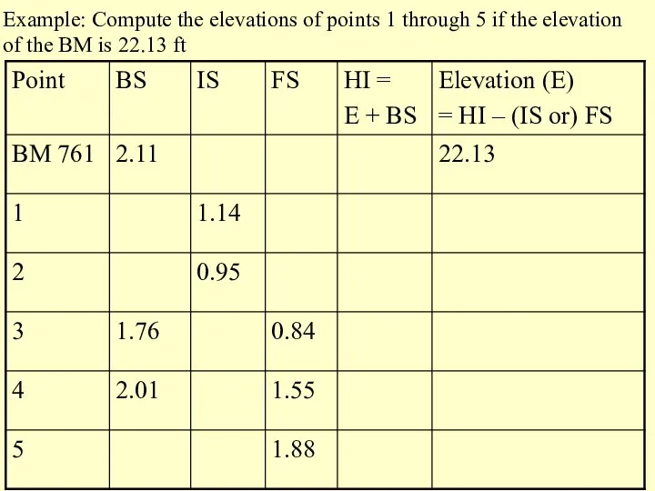
Example: Compute the elevations of points 1 through 5 if the
Example: Compute the elevations of points 1 through 5 if the
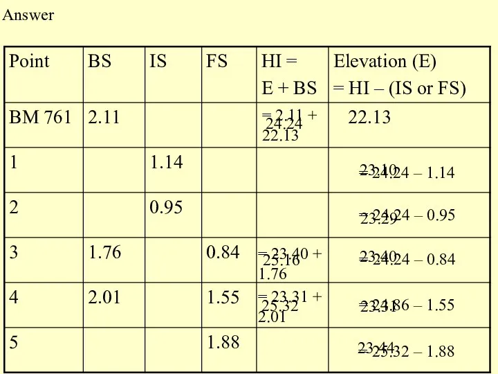
Answer
= 2.11 + 22.13
24.24
= 24.24 – 1.14
23.40
= 24.24 – 0.95
23.10
= 24.24
Answer
= 2.11 + 22.13
24.24
= 24.24 – 1.14
23.40
= 24.24 – 0.95
23.10
= 24.24
Drawing and Using Profiles
Drawn using a software now.The following is for
Drawing and Using Profiles
Drawn using a software now.The following is for
 Война и мир
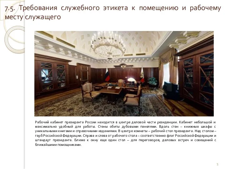 Требования служебного этикета к помещению и рабочему месту служащего
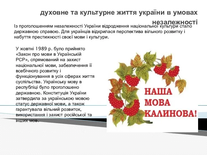 Духовне та культурне життя України в умовах незалежності
 Народные ремесла Ленинградской области
 Цикл с условием в языке Python
 Тема 2. Основные производственные фонды Лектор: к.т.н., доцент, Драгилева Людмила Юрьевна
 обезболивание+неотложка 2015
 Содружество Независимых Государств
 Как отправлять и получать письма в Microsoft Outlook 2003 и 2007
 Тест по БЖД
 Электрические цепи синусоидального тока
  seytumerova_zarema_i_kuzmina_viktoriya (1)
 Мобильное приложение для SMART TV
 Угловая перспектива интерьера
 Анализ и разработка названий брендов сока
 "Призрак оперы" Гастон Леру
 Просторічна лексика
 Интеграция личного сайта с Facebook Создаем сайты на MyWeb http://myweb.kz/
 Кĕсле (гусли)
 Методологические проблемы политологии
 Датчик движения
 Презентация "7 чудес света" - скачать презентации по МХК
 Проект по обществу «Культура»
 Гибридные автомобили. Схема гибридного автомобиля
 Введение в психологию. Предмет, объект и методы психологии Вопросы: 1. Психология как наука и учебная дисциплина 2. Основные з
 Общие сведения об изделиях и их составных частях
 Статья 178 УК РФ. Недопущение, ограничение или устранение конкуренции Подготовила Меженько Юлия
 Самые оригинальные способы мотивации