- Structure and Plate Tectonics

Содержание
- 2. 4- Deformation of Rocks A force causes stress on rocks Rocks near surface are elastic and
- 3. Three Types of Stress 4- Compression – pushes on rocks from opposite directions; shortens rocks Tension
- 4. 4- Earth’s Interior Internal heat source is energy causing metamorphism, uplift of crust (rock cycle) Seismic
- 5. 4- Earth’s Structure
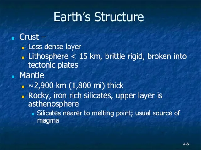
- 6. 4- Earth’s Structure Crust – Less dense layer Lithosphere Mantle ~2,900 km (1,800 mi) thick Rocky,
- 7. Earth’s Interior Scientists hypothesize inner and outer core are iron-nickel alloy Outer core Metallic liquid Inner
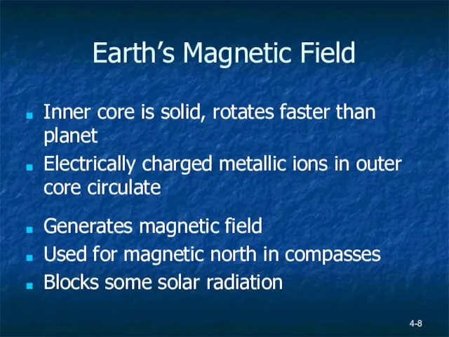
- 8. 4- Earth’s Magnetic Field Inner core is solid, rotates faster than planet Electrically charged metallic ions
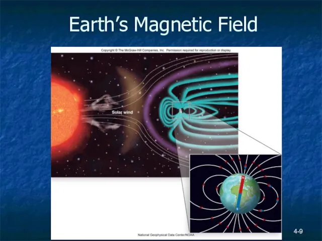
- 9. 4- Earth’s Magnetic Field
- 10. 4- Earth’s Internal Heat Geothermal gradient 25°C/km – temperature increases with depth Heat from radioactive decay
- 11. Earth’s Internal Heat 4-
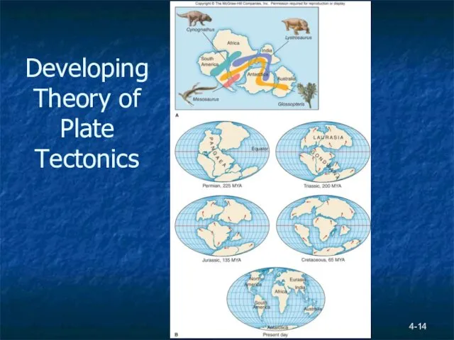
- 12. 4- Continental Drift Idea that continents were once joined first proposed in 1596 by Dutch mapmaker
- 13. Continental Drift Alfred Wegener 1922 book on theory of continental drift More evidence than Taylor –
- 14. 4- Developing Theory of Plate Tectonics
- 15. 4- Developing Theory of Plate Tectonics Mapping ocean floor began in 1855 by U.S. Navy WW1
- 16. Mapping the Ocean Floor 4-
- 17. Magnetic Studies Igneous basalts contain iron mineral magnetite (Fe3O4) Magnetite is naturally magnetic Atoms orient parallel
- 18. Magnetic Reversal Figure 4.11 Page 101
- 19. Sea Floor Spreading Figure 4.12, Page 101 Mid oceanic ridges – magma erupts forming new ocean
- 20. Earthquakes Earthquake – release of energy that occurs when rocks are deformed past their elastic limit
- 21. Earthquake Locations Figure 4.13, Page 102
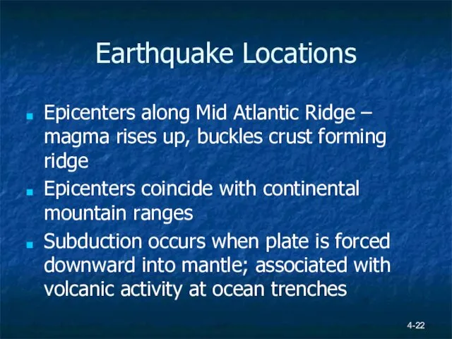
- 22. Earthquake Locations Epicenters along Mid Atlantic Ridge – magma rises up, buckles crust forming ridge Epicenters
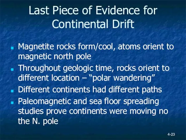
- 23. Last Piece of Evidence for Continental Drift Magnetite rocks form/cool, atoms orient to magnetic north pole
- 24. Polar Wandering 4-
- 25. 4- Plate Tectonics and Earth’s Systems By 1960, 50 years of data proved sea floor spreading
- 26. Plate Tectonics and Earth’s Systems Plate Boundaries defined by epicenters Plates move over asthenosphere Slide past
- 27. 4- Plates
- 28. Plate Boundaries Movement generates compression, tension or shear 3 Types of Boundaries Divergent Convergent Transform See
- 29. 4- Plate Boundaries
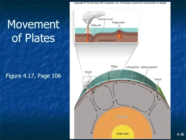
- 30. 4- Movement of Plates Figure 4.17, Page 106
- 31. Surface Features & Plate Boundaries Convergent Oceanic-oceanic island arc; one plates undergoes subduction; may produce an
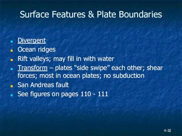
- 32. 4- Surface Features & Plate Boundaries Divergent Ocean ridges Rift valleys; may fill in with water
- 33. Divergent Plate Boundaries 4-
- 34. Convergent Plate Boundaries 4-
- 35. Transform Plate Boundary 4-
- 36. East African Rift Valley 4-
- 37. East African Rift Valley 4-
- 38. Future of African Continent? 4- http://www.pmfias.com/wp-content/uploads/2015/12/East-African-Rift-Valley-break-up.jpg
- 40. Скачать презентацию
4-
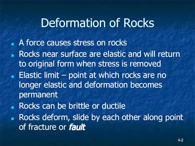
Deformation of Rocks
A force causes stress on rocks
Rocks near surface are
4-
Deformation of Rocks
A force causes stress on rocks
Rocks near surface are
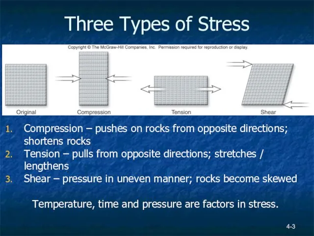
Three Types of Stress
4-
Compression – pushes on rocks from opposite directions;
Three Types of Stress
4-
Compression – pushes on rocks from opposite directions;
4-
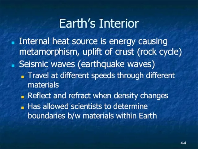
Earth’s Interior
Internal heat source is energy causing metamorphism, uplift of crust
4-
Earth’s Interior
Internal heat source is energy causing metamorphism, uplift of crust
4-
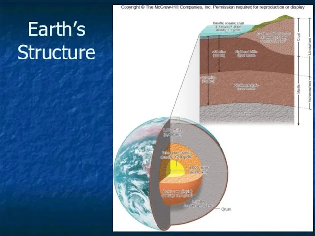
Earth’s Structure
4-
Earth’s Structure
4-
Earth’s Structure
Crust –
Less dense layer
Lithosphere < 15 km, brittle rigid, broken
4-
Earth’s Structure
Crust –
Less dense layer
Lithosphere < 15 km, brittle rigid, broken
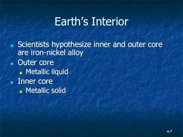
Earth’s Interior
Scientists hypothesize inner and outer core are iron-nickel alloy
Outer
Earth’s Interior
Scientists hypothesize inner and outer core are iron-nickel alloy
Outer
4-
Earth’s Magnetic Field
Inner core is solid, rotates faster than planet
Electrically charged
4-
Earth’s Magnetic Field
Inner core is solid, rotates faster than planet
Electrically charged
4-
Earth’s Magnetic Field
4-
Earth’s Magnetic Field
4-
Earth’s Internal Heat
Geothermal gradient 25°C/km – temperature increases with depth
Heat from
4-
Earth’s Internal Heat
Geothermal gradient 25°C/km – temperature increases with depth
Heat from
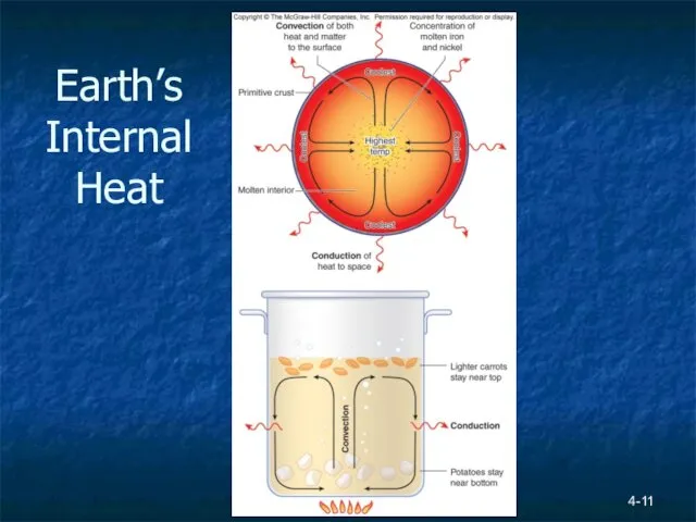
Earth’s Internal Heat
4-
Earth’s Internal Heat
4-
4-
Continental Drift
Idea that continents were once joined first proposed in 1596
4-
Continental Drift
Idea that continents were once joined first proposed in 1596
Continental Drift
Alfred Wegener 1922 book on theory of continental drift
More evidence
Continental Drift
Alfred Wegener 1922 book on theory of continental drift
More evidence
4-
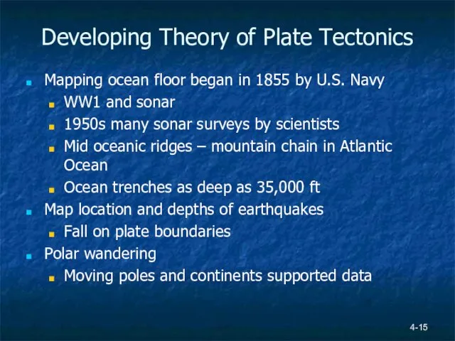
Developing Theory of Plate Tectonics
4-
Developing Theory of Plate Tectonics
4-
Developing Theory of Plate Tectonics
Mapping ocean floor began in 1855 by
4-
Developing Theory of Plate Tectonics
Mapping ocean floor began in 1855 by
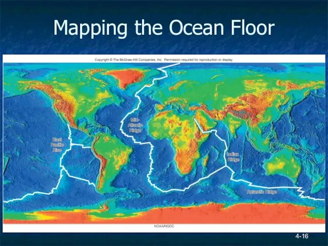
Mapping the Ocean Floor
4-
Mapping the Ocean Floor
4-
Magnetic Studies
Igneous basalts contain iron mineral magnetite (Fe3O4)
Magnetite is naturally magnetic
Atoms
Magnetic Studies
Igneous basalts contain iron mineral magnetite (Fe3O4)
Magnetite is naturally magnetic
Atoms
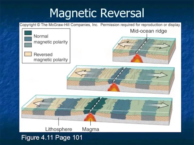
Magnetic Reversal
Figure 4.11 Page 101
Magnetic Reversal
Figure 4.11 Page 101
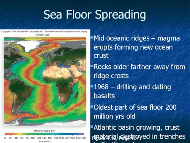
Sea Floor Spreading
Figure 4.12, Page 101
Mid oceanic ridges – magma erupts
Sea Floor Spreading
Figure 4.12, Page 101
Mid oceanic ridges – magma erupts
Earthquakes
Earthquake – release of energy that occurs when rocks are deformed
Earthquakes
Earthquake – release of energy that occurs when rocks are deformed
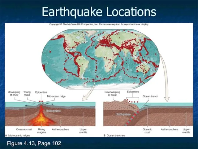
Earthquake Locations
Figure 4.13, Page 102
Earthquake Locations
Figure 4.13, Page 102
Earthquake Locations
Epicenters along Mid Atlantic Ridge – magma rises up, buckles
Earthquake Locations
Epicenters along Mid Atlantic Ridge – magma rises up, buckles
Last Piece of Evidence for Continental Drift
Magnetite rocks form/cool, atoms orient
Last Piece of Evidence for Continental Drift
Magnetite rocks form/cool, atoms orient
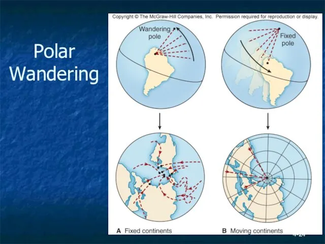
Polar Wandering
4-
Polar Wandering
4-
4-
Plate Tectonics and Earth’s Systems
By 1960, 50 years of data proved
4-
Plate Tectonics and Earth’s Systems
By 1960, 50 years of data proved
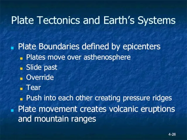
Plate Tectonics and Earth’s Systems
Plate Boundaries defined by epicenters
Plates move over
Plate Tectonics and Earth’s Systems
Plate Boundaries defined by epicenters
Plates move over
4-
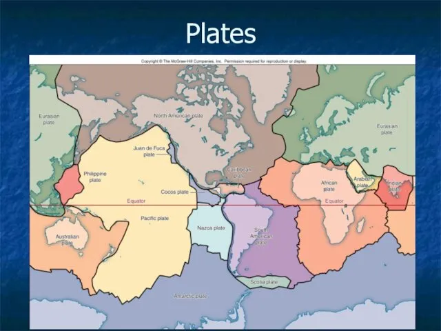
Plates
4-
Plates
Plate Boundaries
Movement generates compression, tension or shear
3 Types of Boundaries
Divergent
Convergent
Transform
See
Plate Boundaries
Movement generates compression, tension or shear
3 Types of Boundaries
Divergent
Convergent
Transform
See
4-
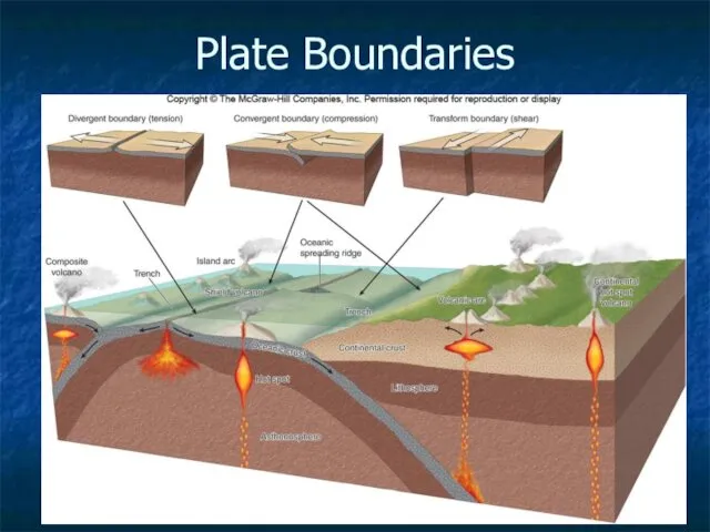
Plate Boundaries
4-
Plate Boundaries
4-
Movement of Plates
Figure 4.17, Page 106
4-
Movement of Plates
Figure 4.17, Page 106
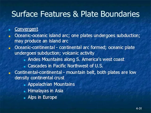
Surface Features & Plate Boundaries
Convergent
Oceanic-oceanic island arc; one plates undergoes subduction;
Surface Features & Plate Boundaries
Convergent
Oceanic-oceanic island arc; one plates undergoes subduction;
4-
Surface Features & Plate Boundaries
Divergent
Ocean ridges
Rift valleys; may fill in
4-
Surface Features & Plate Boundaries
Divergent
Ocean ridges
Rift valleys; may fill in
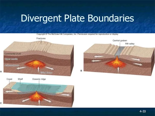
Divergent Plate Boundaries
4-
Divergent Plate Boundaries
4-
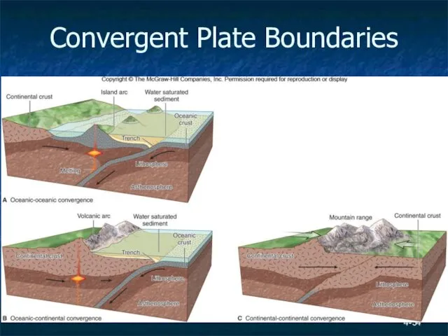
Convergent Plate Boundaries
4-
Convergent Plate Boundaries
4-
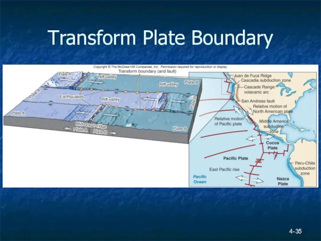
Transform Plate Boundary
4-
Transform Plate Boundary
4-
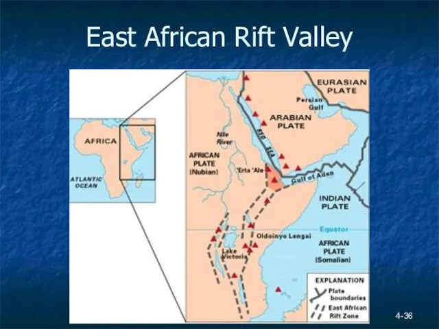
East African Rift Valley
4-
East African Rift Valley
4-
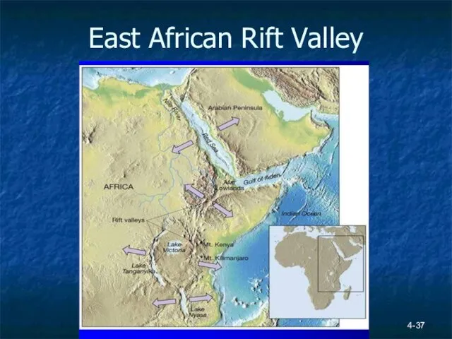
East African Rift Valley
4-
East African Rift Valley
4-
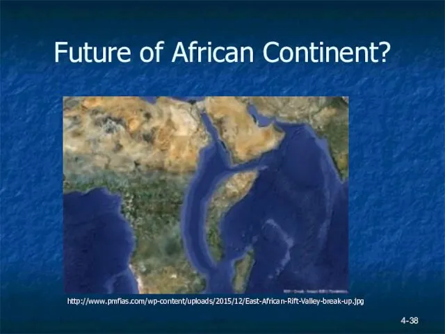
Future of African Continent?
4-
http://www.pmfias.com/wp-content/uploads/2015/12/East-African-Rift-Valley-break-up.jpg
Future of African Continent?
4-
http://www.pmfias.com/wp-content/uploads/2015/12/East-African-Rift-Valley-break-up.jpg
 Древесина и её топливные свойства
  Влияние Магнитного поля Земли на человека - презентация к уроку Географии_
 География (от греч. гео-земля, графо-пишу) География – это наука, описывающая Землю
 Определение координат - презентация к уроку Географии
 Определение места судна в море визуальными методами
 Население мира. Численность, структура и размещение населения
 Визитная карточка Африки
 Italy
Italy Географическое видообразование
 Водные ресурсы Франции
 Внутреннее строение Земли.Горные породы, слагающие земную кору - презентация к уроку Географии_
 Страна Чад - презентация к уроку Географии
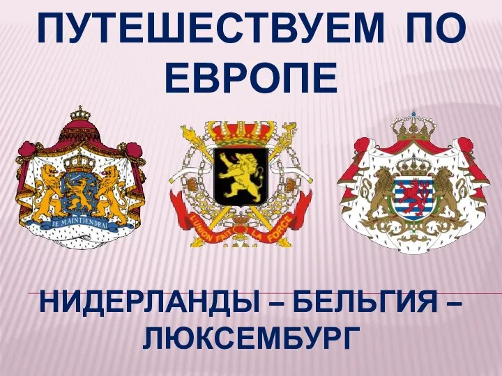 Путешествие по Европе
 Sesavali. Geografiuli mdebareoba, bunebrivi garemo, mosaxleoba
 Әлемдегі ең үздік 10 жағажай
 Топографиялық картадағы тік бұрыштық координаталарын анықтау
 Внутренние воды северной Америки 7 класс - презентация к уроку Географии_
 Республика Алтай и Алтайский Край
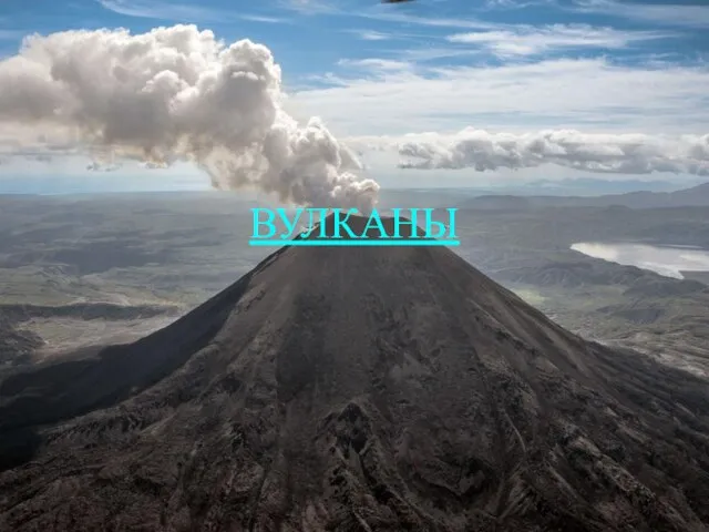 Вулканы. Схема образования вулкана
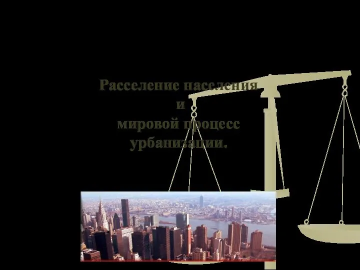 Расселение населения и мировой процесс урбанизации
 Калининград. Калининградская область
 Въездной и выездной туризм Мурманской области
 Путешествие в Индонезию Мы с вами отправимся в путешествие за экватор.
 Озеро Байкал
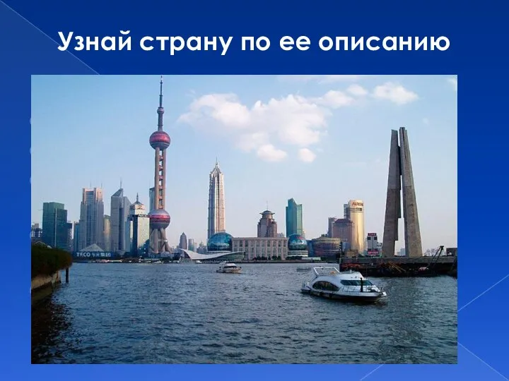 Узнай страну по ее описанию
 12-бальная шкала для оценки силы землетрясения
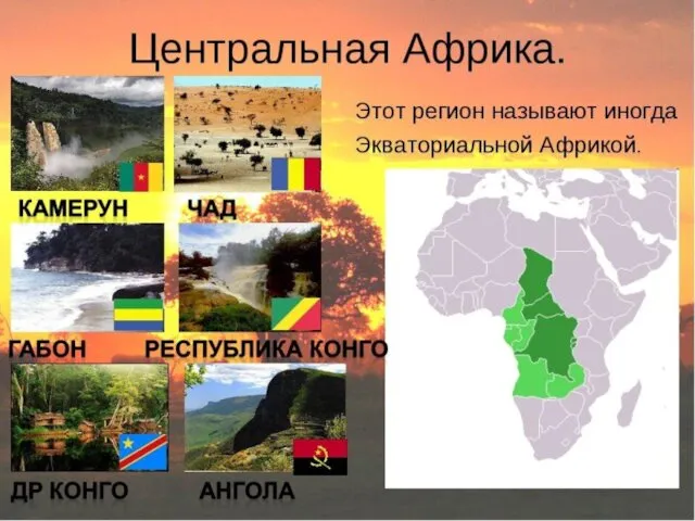 Центральная Африка
 Береговые формы рельефа и формирующие их процессы