- Adelaide

Содержание
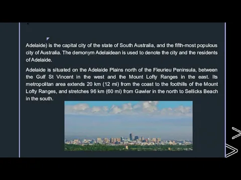
- 2. Adelaide) is the capital city of the state of South Australia, and the fifth-most populous city
- 3. Named in honour of Queen Adelaide, consort to King William IV, the city was founded in
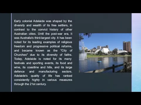
- 4. Early colonial Adelaide was shaped by the diversity and wealth of its free settlers, in contrast
- 5. History South Australia was officially established as a British Province in England in February 1836. The
- 6. In July 1876, the Illustrated Sydney News published a special supplement that included an early aerial
- 7. 20th century Adelaide was Australia's third largest city for most of the 20th century.mElectric street lighting
- 8. 21st century In the early years of the 21st century, a significant increase in the state
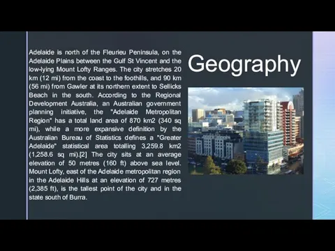
- 9. Geography Adelaide is north of the Fleurieu Peninsula, on the Adelaide Plains between the Gulf St
- 10. Climate Adelaide has a hot-summer Mediterranean climate (Köppen climate classification: Csa).[71] The city has hot, dry
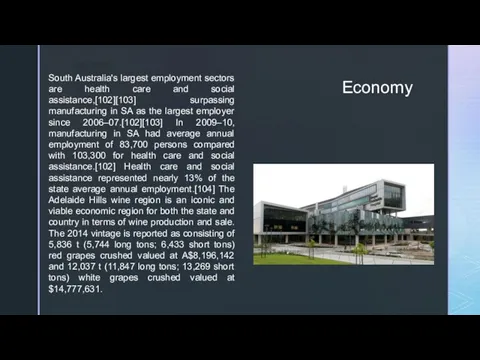
- 11. Economy South Australia's largest employment sectors are health care and social assistance,[102][103] surpassing manufacturing in SA
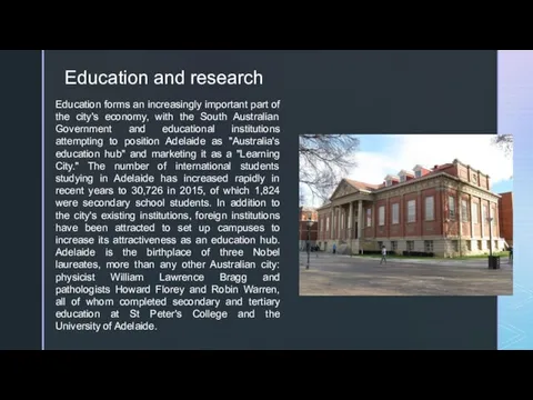
- 12. Education and research Education forms an increasingly important part of the city's economy, with the South
- 14. Скачать презентацию
Adelaide) is the capital city of the state of South Australia,
Adelaide) is the capital city of the state of South Australia,

Named in honour of Queen Adelaide, consort to King William IV,
Named in honour of Queen Adelaide, consort to King William IV,
Early colonial Adelaide was shaped by the diversity and wealth of
Early colonial Adelaide was shaped by the diversity and wealth of
History
South Australia was officially established as a British Province in England
History
South Australia was officially established as a British Province in England

In July 1876, the Illustrated Sydney News published a special supplement that included
In July 1876, the Illustrated Sydney News published a special supplement that included
20th century
Adelaide was Australia's third largest city for most of the
20th century
Adelaide was Australia's third largest city for most of the

21st century
In the early years of the 21st century, a significant
21st century
In the early years of the 21st century, a significant
Geography
Adelaide is north of the Fleurieu Peninsula, on the Adelaide Plains
Geography
Adelaide is north of the Fleurieu Peninsula, on the Adelaide Plains
![Climate Adelaide has a hot-summer Mediterranean climate (Köppen climate classification: Csa).[71]](/_ipx/f_webp&q_80&fit_contain&s_1440x1080/imagesDir/jpg/555870/slide-9.jpg)
Climate
Adelaide has a hot-summer Mediterranean climate (Köppen climate classification: Csa).[71] The
Climate
Adelaide has a hot-summer Mediterranean climate (Köppen climate classification: Csa).[71] The
Economy
South Australia's largest employment sectors are health care and social assistance,[102][103]
Economy
South Australia's largest employment sectors are health care and social assistance,[102][103]
Education and research
Education forms an increasingly important part of the city's
Education and research
Education forms an increasingly important part of the city's
 Иван VI (Иоанн III) Антонович: 5-й император всероссийский 17 (28) октября 1740 — 25 ноября (6 декабря) 1741 Рождение: 12 (23) августа 1740 года,
 19 мая – День пионерии
 Архитектура и дизайн XX века Модерн Чарлз Ренни Макинтош
 Научные открытия и изобретения. (урок 30)
 Кубань XVII в. – 70-е г. XVIII в. Основные потоки переселенцев на Кубань
 Книга памяти, 6А класс
 Сказание о Борисе и Глебе
 ТЕМА VI. РОССИЯ В XVI веке. Внутренняя политика Ивана IV (1547-1584 гг.)
 Крестьянская война Пугачева
 Краткосрочный курс для 8 класса Автор: Москвина И.И., учитель истории МБОУ «Сивинская СОШ»
 Россия в XVII веке. Смутное время
 Новое искусство в 1920-х годах
 История российского флага
 Презентация на тему "Внутренняя политика Екатерины II 1762-1796" - презентации по Истории
  Наследники пути русских адмиралов
 Сталинград. 200 дней мужества и стойкости
 Презентация на тему "Крестьяне и феодалы" - презентации по Истории скачать
  Акция в рамках празднования 630-летия города Бобруйска
 Великая Отечественная война. Герои комсомольцы. Подвиги молодых
 Выполните тестирование
  Восстание Емельяна Пугачёва
 20140525_tserkov_i_gosudarstvo_v_kontse_xv-_nachale_xvi_v._chast_1
 Капіталістична еволюція України у складі Російської імперії, її особливості
 Деятели литературы и искусства на защите Отечества в годы Великой Отечественной войны
 Торгово-пошлинные отношения на Руси (IX – XVII вв.)
 История кино
 Италия в конце XX – начале XXI веков
 Достопримечательности Пскова