Nationalization of indicators for sustainable development goals in the Kazakhstan through geoinformation technologies
- Nationalization of indicators for sustainable development goals in the Kazakhstan through geoinformation technologies

Содержание
- 2. Sustainable Development Goals What is SDG s? The Sustainable Development Goals (SDGs) were adopted by the
- 3. Kazakhstan and Sustainable Development Goals
- 4. Kazakhstan and Sustainable Development Goals
- 5. Current situation of SDG s indicators in Kazakhstan
- 6. Current situation of SDG indicators in Kazakhstan National SDG reporting platform Bureau of National Statistics of
- 7. Достижения и вызовы Казахстана по целям устойчивого развития (1)
- 8. Достижения и вызовы Казахстана по целям устойчивого развития (2)
- 9. Достижения и вызовы Казахстана по целям устойчивого развития (3)
- 10. Достижения и вызовы Казахстана по целям устойчивого развития (4)
- 11. Eradicate extreme poverty and Hunger
- 12. http://ais.kaznu.kz/index
- 13. Algorithm for the use of geoinformation technologies in the management of QoL indicators for the SDGs
- 15. Database on indicators of QoL of RK is formed according to 4 blocks indicators, which indicate
- 17. At present, it is becoming easier to obtain spatial geographic data, but the key point is
- 19. Скачать презентацию
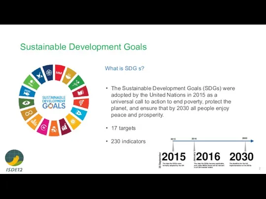
Sustainable Development Goals
What is SDG s?
The Sustainable Development Goals (SDGs)
Sustainable Development Goals
What is SDG s?
The Sustainable Development Goals (SDGs)
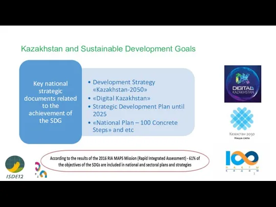
Kazakhstan and Sustainable Development Goals
Kazakhstan and Sustainable Development Goals
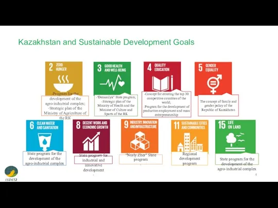
Kazakhstan and Sustainable Development Goals
Kazakhstan and Sustainable Development Goals
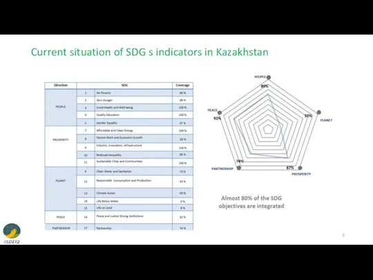
Current situation of SDG s indicators in Kazakhstan
Current situation of SDG s indicators in Kazakhstan
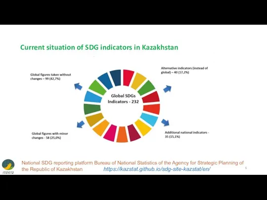
Current situation of SDG indicators in Kazakhstan
National SDG reporting platform Bureau
Current situation of SDG indicators in Kazakhstan
National SDG reporting platform Bureau

Достижения и вызовы Казахстана по целям устойчивого развития (1)
Достижения и вызовы Казахстана по целям устойчивого развития (1)
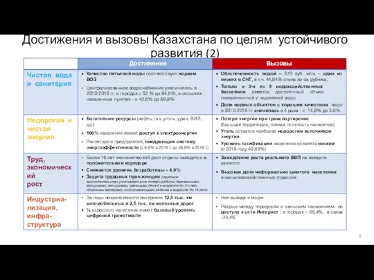
Достижения и вызовы Казахстана по целям устойчивого развития (2)
Достижения и вызовы Казахстана по целям устойчивого развития (2)
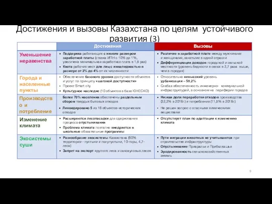
Достижения и вызовы Казахстана по целям устойчивого развития (3)
Достижения и вызовы Казахстана по целям устойчивого развития (3)
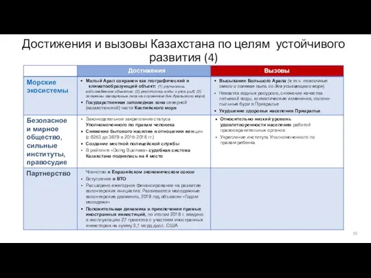
Достижения и вызовы Казахстана по целям устойчивого развития (4)
Достижения и вызовы Казахстана по целям устойчивого развития (4)
Eradicate extreme poverty and Hunger
Eradicate extreme poverty and Hunger
http://ais.kaznu.kz/index
http://ais.kaznu.kz/index
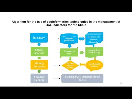
Algorithm for the use of geoinformation technologies in the management of
Algorithm for the use of geoinformation technologies in the management of
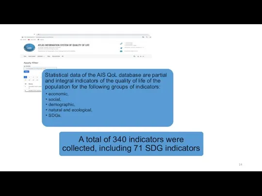
Database on indicators of QoL of RK is formed according to
Database on indicators of QoL of RK is formed according to

At present, it is becoming easier to obtain spatial geographic data,
At present, it is becoming easier to obtain spatial geographic data,
 Введение в НТМL. Язык разметки гипертекста
 Методологические основы принятия решений для сложных систем
 Presentation template
 Тема урока: «Организация ветвлений на Паскале»
 Презентация "Письменность и кодирование информации" - скачать презентации по Информатике
 Информационные технологии в журналистике Выполнила: Вера Букина, ИФиЯК
 Информационная обработка текстов. Готовимся к ЕГЭ 2018
 Алгоритмы удаления скрытых линий и поверхностей
 Поиск клинико-практического руководства по антихеликобактерной терапии по базам электронных ресурсов
 Информационная культура
 Базы данных 11 класс
 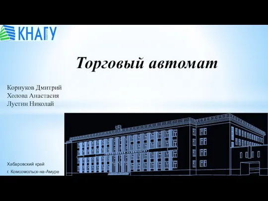 Торговый автомат
 Программное обеспечение информационных технологий
 JavaScript kursas
 Общие принципы построения и использования языков программирования. Компьютерная память. Работа с данными в языках программирования
 Проектирование информационных систем
 Программное обеспечение компьютера 8 класс
 Топологические модели построения сети
 ВКонтакте за чашкой кофе
 Нужен ли в школе Wi-Fi?
 Киберспорт. Перспективы развития
 Аудит информационной безопасности
 Презентация "Реляционное исчисление" - скачать презентации по Информатике
 Кодирование информации (2лекция)
 Презентация "СИСТЕМЫ СЧИСЛЕНИЯ" - скачать презентации по Информатике
 Информационные системы и программирование
 Оплата мероприятий
 Файлы
Файлы