- User experiences of SAF products and their implementation

Содержание
- 2. Cooperation with Eumetsat In December 2004, a Cooperating State Agreement was concluded At the end of
- 3. Satellite data in LHMT Data comming via EUMETCAST: Space-based observations from the Meteosat and Metop satellites.
- 4. Software IBL “Visual Weather” – weather forecasters work station + IBL “Satellite weather” SCISYS “2met!®” -
- 5. “Satellite weather” Easy displays various satellite data, creates products and RGB Adjusts the satellite display (change
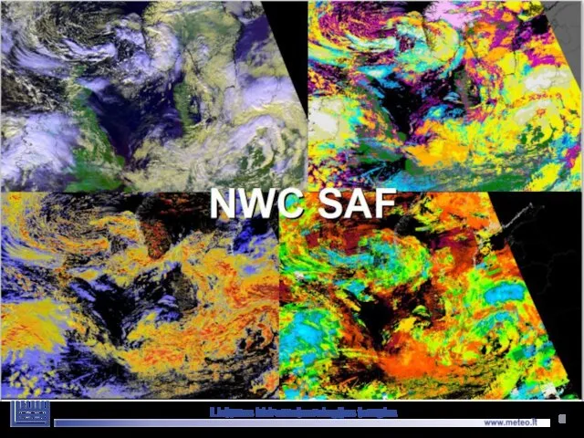
- 6. Lietuvos hidrometeorologijos tarnyba
- 7. NWC SAF - the Satellite Application Facility on support to Nowcasting is a Consortium between Eumetsat
- 8. NWC/PPS SHMI are responsible for the development and maintenance of the Polar Platform System package (the
- 9. NWC/PPS Lithuanian Hydrometeorological Service
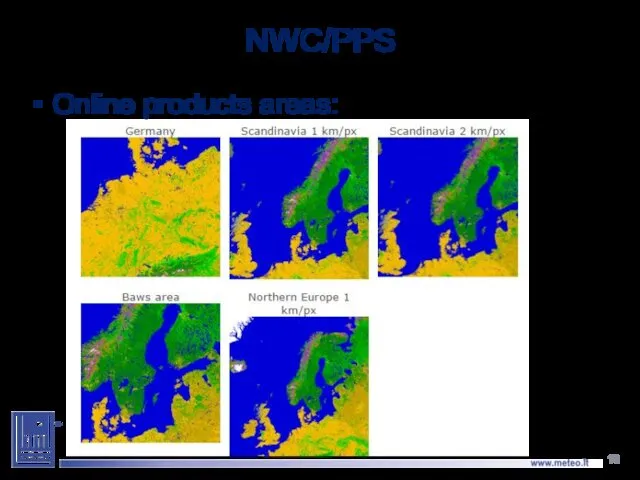
- 10. NWC/PPS Online products areas:
- 11. NWC/PPS Cloud Lithuanian Hydrometeorological Service 8:20 UTC Metop 10:48 UTC Aqua 10:32 UTC NPP
- 12. NWC/PPS Cloud Type Lithuanian Hydrometeorological Service 15:41 UTC NOAA18 12:26 UTC Aqua 12:07 UTC NOAA 19
- 13. NWC/PPS Cloud Type Lithuanian Hydrometeorological Service 15:41 UTC NOAA18 12:26 UTC Aqua 14:59 UTC NOAA15
- 14. NWC/PPS Precipitating Clouds Lithuanian Hydrometeorological Service 8:20 UTC Metop 14:59 UTC NOAA15 15:41 UTC NOAA18
- 15. NWC/GEO products NWC/GEO - MSG Reference System Outputs Cloud Products: (CMA) Cloud Mask; (CT) Cloud Type;
- 16. http://www.nwcsaf.org/ Data for 24 hours in 3 hour step, for last 3 hours in 15 minutes
- 17. http://eumetview.eumetsat.int/mapviewer/ Data for 7 days in 3 hour step Lietuvos hidrometeorologijos tarnyba
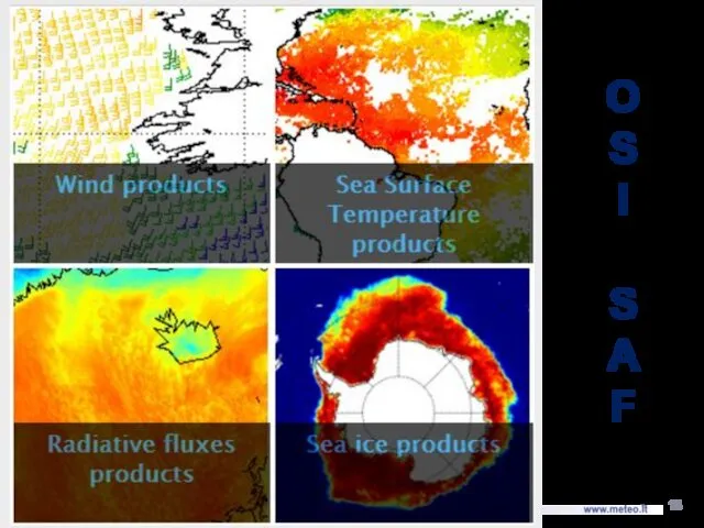
- 18. O S I S A F Lietuvos hidrometeorologijos tarnyba
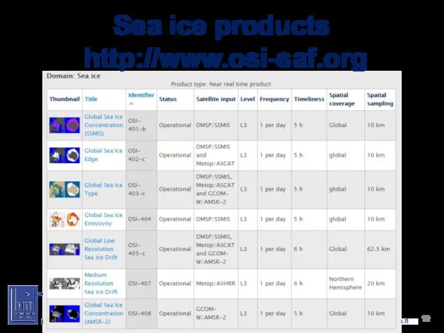
- 19. Sea ice products http://www.osi-saf.org Lietuvos hidrometeorologijos tarnyba
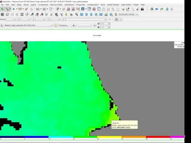
- 20. Sea Surface Temperature Lietuvos hidrometeorologijos tarnyba
- 21. Sea Surface Temperature Lietuvos hidrometeorologijos tarnyba
- 22. Lietuvos hidrometeorologijos tarnyba
- 23. Wind products Lietuvos hidrometeorologijos tarnyba
- 24. What are Scatterometers? Scatterometers are microwave radar instruments specifically designed to measure near surface ocean wind
- 25. Backscatter modulation by surface roughness ® Z.Jelenak
- 26. Lietuvos hidrometeorologijos tarnyba
- 27. Scatterometers Lietuvos hidrometeorologijos tarnyba
- 28. Scatterometers in 12,5 km resolution Lietuvos hidrometeorologijos tarnyba
- 29. Scatterometers in big lakes Lietuvos hidrometeorologijos tarnyba
- 30. Fog in Baltic sea 2014-06-10 18:00 UTC 2014-06-11 12:00 UTC
- 31. UK Met Office. 2012. GHRSST Level 4 OSTIA Global Foundation Sea Surface Temperature Analysis (GDS version
- 32. Upwellings usually begin to occur from late April and last till September. Upwelling is often formed
- 33. OSI SAF products Lietuvos hidrometeorologijos tarnyba
- 35. Скачать презентацию
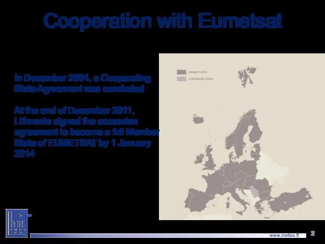
Cooperation with Eumetsat
In December 2004, a Cooperating State Agreement was concluded
At
Cooperation with Eumetsat
In December 2004, a Cooperating State Agreement was concluded
At
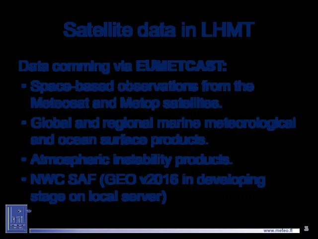
Satellite data in LHMT
Data comming via EUMETCAST:
Space-based observations from the
Satellite data in LHMT
Data comming via EUMETCAST:
Space-based observations from the
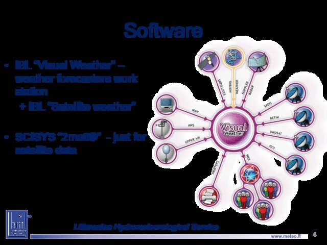
Software
IBL “Visual Weather” – weather forecasters work station
+ IBL “Satellite weather”
SCISYS
Software
IBL “Visual Weather” – weather forecasters work station
+ IBL “Satellite weather”
SCISYS
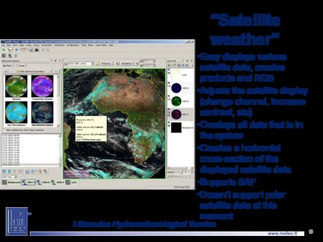
“Satellite weather”
Easy displays various satellite data, creates products and RGB
Adjusts the
“Satellite weather”
Easy displays various satellite data, creates products and RGB
Adjusts the
Lietuvos hidrometeorologijos tarnyba
Lietuvos hidrometeorologijos tarnyba
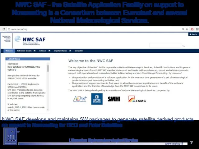
NWC SAF - the Satellite Application Facility on support to Nowcasting
NWC SAF - the Satellite Application Facility on support to Nowcasting
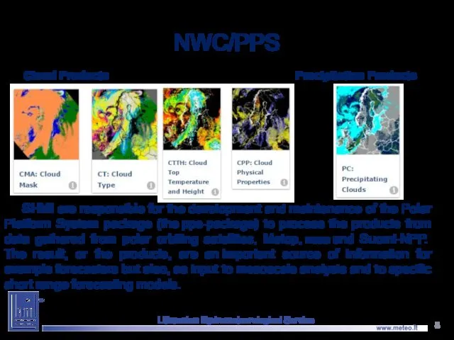
NWC/PPS
SHMI are responsible for the development and maintenance of the Polar
NWC/PPS
SHMI are responsible for the development and maintenance of the Polar
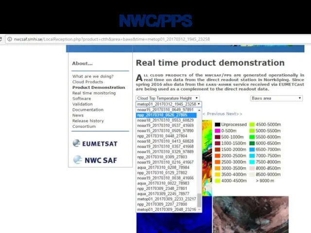
NWC/PPS
Lithuanian Hydrometeorological Service
NWC/PPS
Lithuanian Hydrometeorological Service
NWC/PPS
Online products areas:
NWC/PPS
Online products areas:
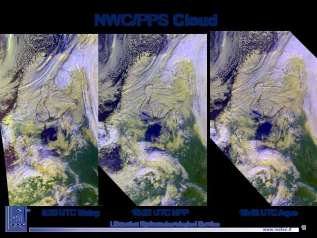
NWC/PPS Cloud
Lithuanian Hydrometeorological Service
8:20 UTC Metop
10:48 UTC Aqua
10:32 UTC NPP
NWC/PPS Cloud
Lithuanian Hydrometeorological Service
8:20 UTC Metop
10:48 UTC Aqua
10:32 UTC NPP
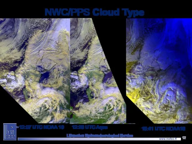
NWC/PPS Cloud Type
Lithuanian Hydrometeorological Service
15:41 UTC NOAA18
12:26 UTC Aqua
12:07 UTC NOAA
NWC/PPS Cloud Type
Lithuanian Hydrometeorological Service
15:41 UTC NOAA18
12:26 UTC Aqua
12:07 UTC NOAA
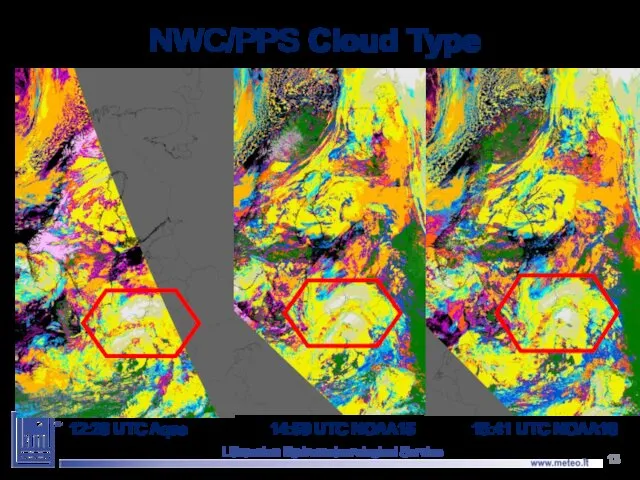
NWC/PPS Cloud Type
Lithuanian Hydrometeorological Service
15:41 UTC NOAA18
12:26 UTC Aqua
14:59 UTC NOAA15
NWC/PPS Cloud Type
Lithuanian Hydrometeorological Service
15:41 UTC NOAA18
12:26 UTC Aqua
14:59 UTC NOAA15
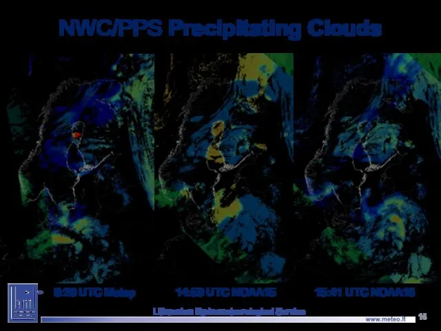
NWC/PPS Precipitating Clouds
Lithuanian Hydrometeorological Service
8:20 UTC Metop
14:59 UTC NOAA15
15:41 UTC NOAA18
NWC/PPS Precipitating Clouds
Lithuanian Hydrometeorological Service
8:20 UTC Metop
14:59 UTC NOAA15
15:41 UTC NOAA18
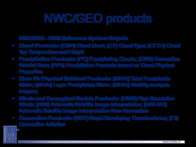
NWC/GEO products
NWC/GEO - MSG Reference System Outputs
Cloud Products: (CMA) Cloud Mask;
NWC/GEO products
NWC/GEO - MSG Reference System Outputs
Cloud Products: (CMA) Cloud Mask;
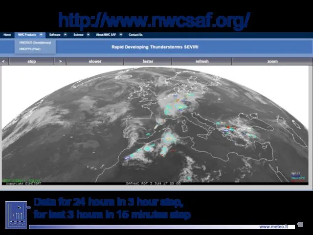
http://www.nwcsaf.org/
Data for 24 hours in 3 hour step,
for last 3
http://www.nwcsaf.org/
Data for 24 hours in 3 hour step,
for last 3
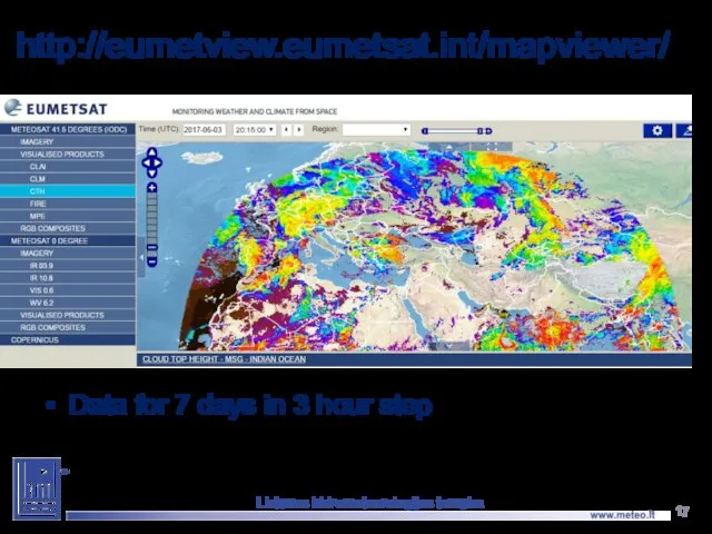
http://eumetview.eumetsat.int/mapviewer/
Data for 7 days in 3 hour step
Lietuvos hidrometeorologijos tarnyba
http://eumetview.eumetsat.int/mapviewer/
Data for 7 days in 3 hour step
Lietuvos hidrometeorologijos tarnyba
O
S
I
S
A
F
Lietuvos hidrometeorologijos tarnyba
O
S
I
S
A
F
Lietuvos hidrometeorologijos tarnyba
Sea ice products
http://www.osi-saf.org
Lietuvos hidrometeorologijos tarnyba
Sea ice products
http://www.osi-saf.org
Lietuvos hidrometeorologijos tarnyba
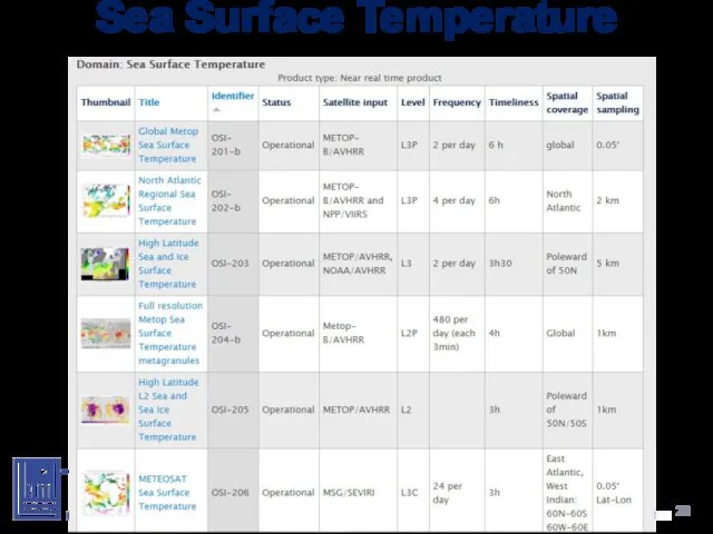
Sea Surface Temperature
Lietuvos hidrometeorologijos tarnyba
Sea Surface Temperature
Lietuvos hidrometeorologijos tarnyba
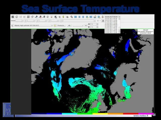
Sea Surface Temperature
Lietuvos hidrometeorologijos tarnyba
Sea Surface Temperature
Lietuvos hidrometeorologijos tarnyba
Lietuvos hidrometeorologijos tarnyba
Lietuvos hidrometeorologijos tarnyba
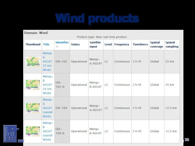
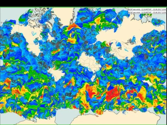
Wind products
Lietuvos hidrometeorologijos tarnyba
Wind products
Lietuvos hidrometeorologijos tarnyba
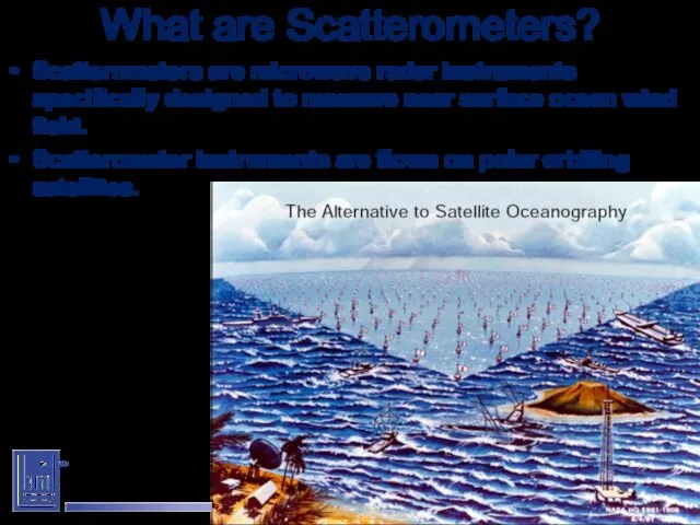
What are Scatterometers?
Scatterometers are microwave radar instruments specifically designed to measure
What are Scatterometers?
Scatterometers are microwave radar instruments specifically designed to measure
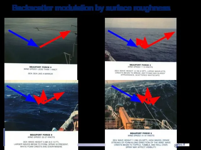
Backscatter modulation by surface roughness
® Z.Jelenak
Backscatter modulation by surface roughness
® Z.Jelenak
Lietuvos hidrometeorologijos tarnyba
Lietuvos hidrometeorologijos tarnyba
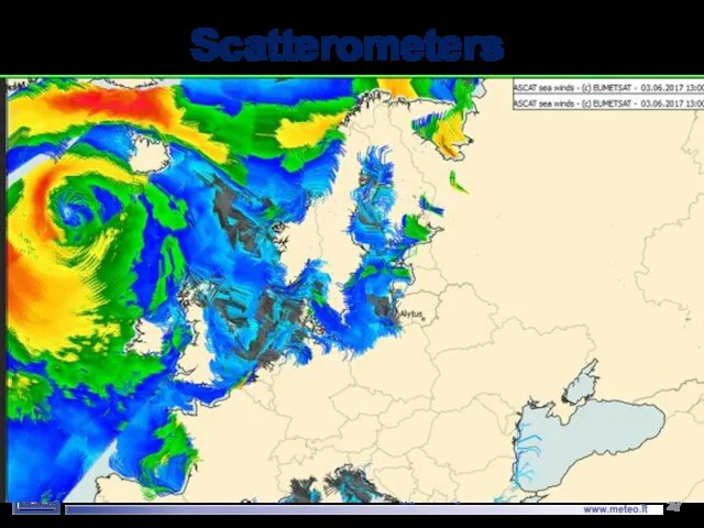
Scatterometers
Lietuvos hidrometeorologijos tarnyba
Scatterometers
Lietuvos hidrometeorologijos tarnyba
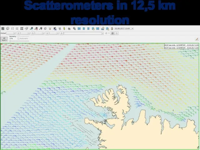
Scatterometers in 12,5 km resolution
Lietuvos hidrometeorologijos tarnyba
Scatterometers in 12,5 km resolution
Lietuvos hidrometeorologijos tarnyba
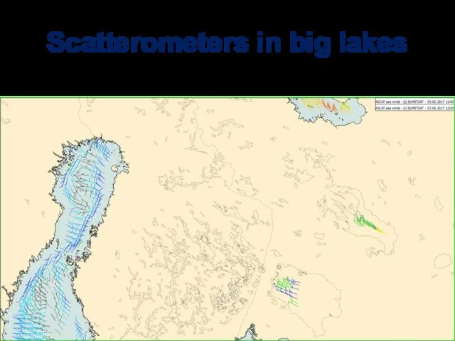
Scatterometers in big lakes
Lietuvos hidrometeorologijos tarnyba
Scatterometers in big lakes
Lietuvos hidrometeorologijos tarnyba
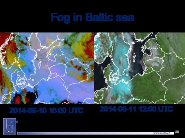
Fog in Baltic sea
2014-06-10 18:00 UTC
2014-06-11 12:00 UTC
Fog in Baltic sea
2014-06-10 18:00 UTC
2014-06-11 12:00 UTC
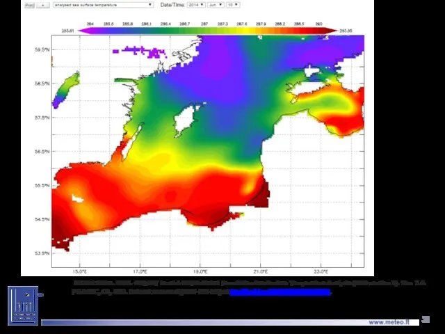
UK Met Office. 2012. GHRSST Level 4 OSTIA Global Foundation
UK Met Office. 2012. GHRSST Level 4 OSTIA Global Foundation
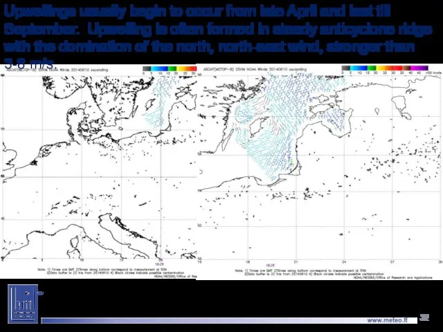
Upwellings usually begin to occur from late April and last till
Upwellings usually begin to occur from late April and last till
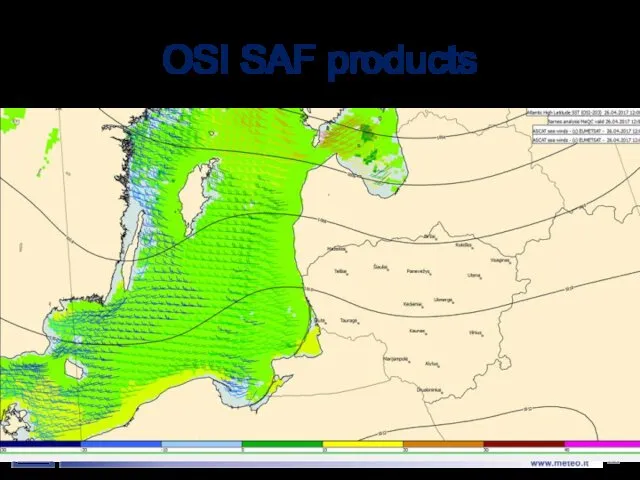
OSI SAF products
Lietuvos hidrometeorologijos tarnyba
OSI SAF products
Lietuvos hidrometeorologijos tarnyba
 Спортивно-гостиничный комплекс AquaLife
 Билль о миссии, целях и задачах
 Умная смарт-скакалка Smart Rope
 Қонақжайлылық индустриясындағы маркетингтік стратегия
 Защита от вирусов - крепкий иммунитет
 План продвижения
 Презентация компании ТАУЭР. www.towercom.ru
 Законы развития организации
 Айдентика фирменного стиля арт - кафе
 Участие в проекте Визитница
 Naturelle - органические медовые муссы
 Правила оформления проекта по продвижению технологии (услуги, товара)
 Больше возможностей с МТС
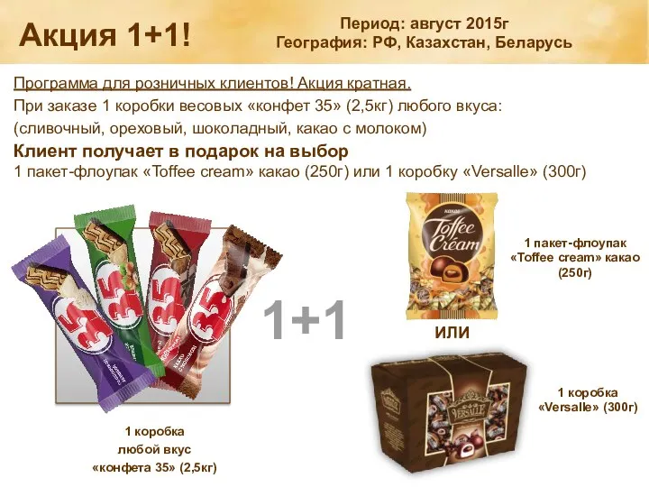 Акция 1+1! Программа для розничных клиентов!
 Виды рекламы
 Антидесерты
 Фабрика Ферреро. История компании
 Техника продаж. Выявление потребностей
 Sergiy Dmutrovuch Prutula
 Luce della Luna. Салон для молодёжи
 Описание преимуществ моделей ТМ Валерия для покупателя
 Отдел продаж Морская лавка и производство макетов Nordmodelist
 Обучение по продуктам. География. Миссия. Преимущества компании
 Шаблон. Логотип компании, слоган
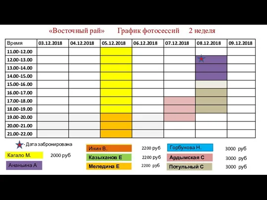 График фотосессий. Фотостудия Восточный Рай
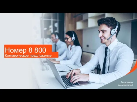 _8800 _
 Ценовая политика предприятия сферы сервиса
 Шаблон. Crew meeting. Ресторан Фучика