- A.P. Karpinsky Russian geological research institute

Содержание
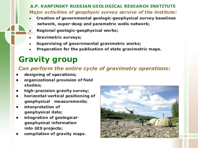
- 2. A.P. KARPINSKY RUSSIAN GEOLOGICAL RESEARCH INSTITUTE Can perform the entire cycle of gravimetry operations: designing of
- 3. Application areas of the modern high-precision gravimetry: Regional surveys - structural-tectonic zoning, search for oil basins;
- 4. Gravity group Is equipped with the state-of-the-art gravimetry and satellite instrumentation of geodetic class, all-terrain vehicles
- 5. Gravimetrical equipment Automated gravity meters AUTOGRAV CG-5 «Scintrex» These instruments are today the highest accuracy ones
- 6. Satellite geodetic equipment Trimble R7 GNSS , Javad Legacy-E Measurement accuracy – a few cm. Satellite
- 7. Computer engineering and software Field laboratory processing is performed daily on portable computers (NB) in field
- 8. PROCEDURE AND TECHNIQUE OF FIELD OPERATIONS Gravity survey Gravity measurements are made in compliance with the
- 9. Topogeodetic operations are carried out with the view of horizontal-vertical positioning for gravity observation stations. They
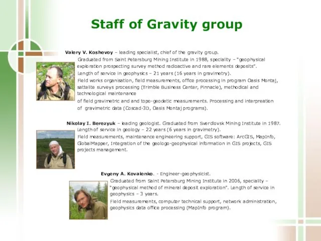
- 10. Staff of Gravity group Valery V. Koshevoy – leading specialist, chief of the gravity group. Graduated
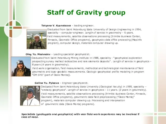
- 11. Staff of Gravity group Tatyana V. Kuznetsova – leading engineer. Graduated from Saint Petersburg State University
- 12. The following work was performed by the gravity party ● over Taimyr Peninsula: Cape Chelyuskin (Scale
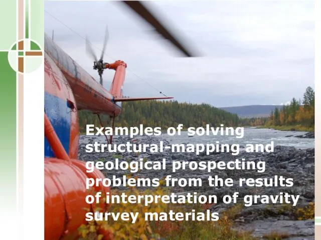
- 13. Examples of solving structural-mapping and geological prospecting problems from the results of interpretation of gravity survey
- 14. State gravity survey on a 1:200 000 scale. Gravity investigations were carried out in the trans-polar
- 15. Map showing Bouguer gravity anomalies The gravity field on the map reflects the main structural elements
- 16. For solving structural-tectonic and prediction-prospecting problems the following different transforms of potential fields were used: Map
- 17. The scheme shows the main tectonic dislocations and geoblocks, contrastingly reflected in the gravity field Structural-tectonic
- 18. The section shows a modelled relief of the roof of Pre-Riphean crystalline basement and the boundaries
- 19. Sketch showing the sites promising for the detection of gold, copper-silver and polymetallic mineralization
- 20. Ground gravity surveys on a 1 : 50 000 scale for the study of the morphology
- 21. Map showing Bouguer gravity anomalies The gravity anomaly map reflects the total gravity effect from the
- 22. For solving structural-tectonic and prediction-prospecting problems practically the entire set of transforms of potential fields was
- 23. Structural-tectonic scheme The scheme shows the main elements of the geological structure of the study area,
- 24. 3D density model The 3D model reflects the main gravitating geological targets: an uplifted block of
- 25. Geological-geophysical sections The sections show the shape and occurrence of potential ore-bearing intrusive bodies, modelled from
- 26. Sketch showing the promising sites The sketch shows the sites delineated for exploration drilling from the
- 27. Salt tectonics mapping from the materials of gravity surveys on scales of 1 : 200 000
- 28. Local isometric negative anomalies of excess density reflect salt dome structures (salt diapirs) Map showing the
- 29. The salt dome on the flanks of which the oil pools were intersected Section of the
- 30. 3D model of a salt diapir Map showing the Bouguer anomalies Salt diapir
- 31. Identification of the hydrocarbon structures and traps promising for oil and gas from the results of
- 32. The 3D model shows the main gravitating structural surfaces, the total effect of which is exhibited
- 33. Structural-tectonic zones traced from the highs of the full horizontal gradient of the gravity field Known
- 34. Integrated interpretation of materials of seismic and gravity exploration investigations – detection of density heterogeneities in
- 35. The efficiency estimation of gravimetric data use for identifying rift structure in Mongolia
- 37. Скачать презентацию
A.P. KARPINSKY RUSSIAN GEOLOGICAL RESEARCH INSTITUTE
Can perform the entire cycle
A.P. KARPINSKY RUSSIAN GEOLOGICAL RESEARCH INSTITUTE
Can perform the entire cycle
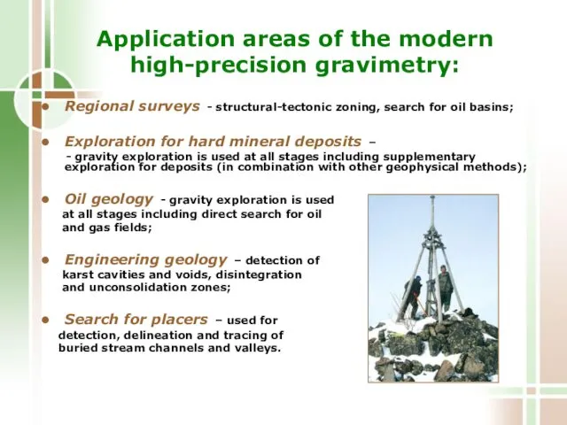
Application areas of the modern
high-precision gravimetry:
Regional surveys - structural-tectonic zoning,
Application areas of the modern
high-precision gravimetry:
Regional surveys - structural-tectonic zoning,
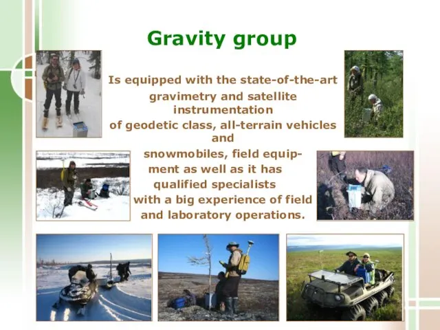
Gravity group
Is equipped with the state-of-the-art
gravimetry and satellite instrumentation
of
Gravity group
Is equipped with the state-of-the-art
gravimetry and satellite instrumentation
of
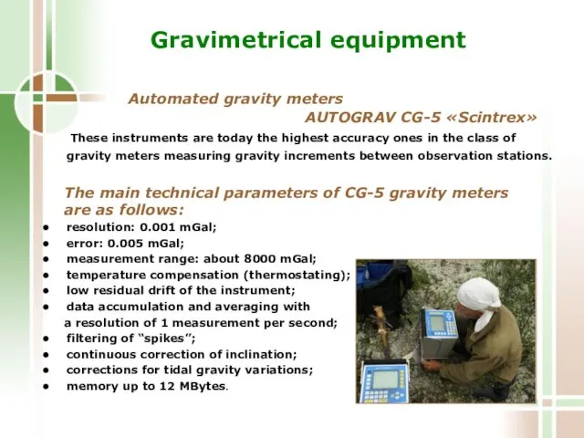
Gravimetrical equipment
Automated gravity meters AUTOGRAV CG-5 «Scintrex»
These instruments are
Gravimetrical equipment
Automated gravity meters AUTOGRAV CG-5 «Scintrex»
These instruments are
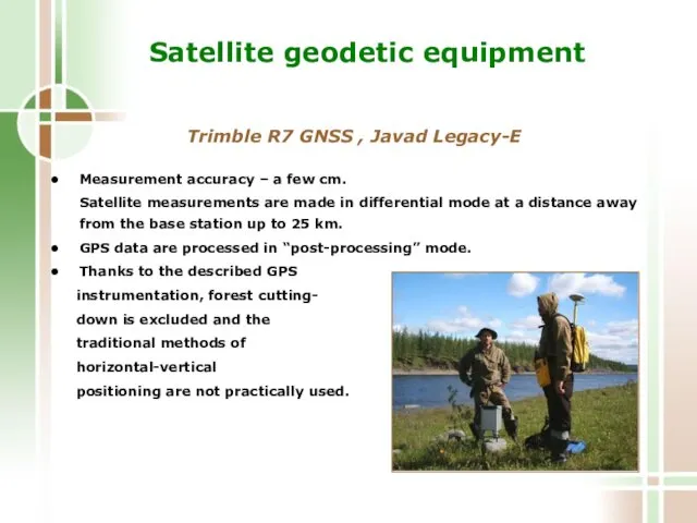
Satellite geodetic equipment
Trimble R7 GNSS , Javad Legacy-E
Measurement accuracy
Satellite geodetic equipment
Trimble R7 GNSS , Javad Legacy-E
Measurement accuracy
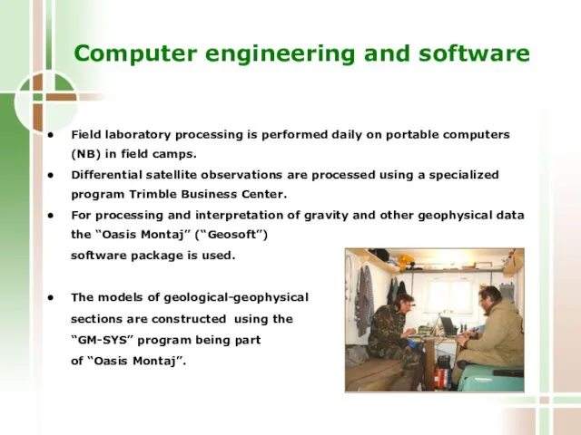
Computer engineering and software
Field laboratory processing is performed daily on
Computer engineering and software
Field laboratory processing is performed daily on
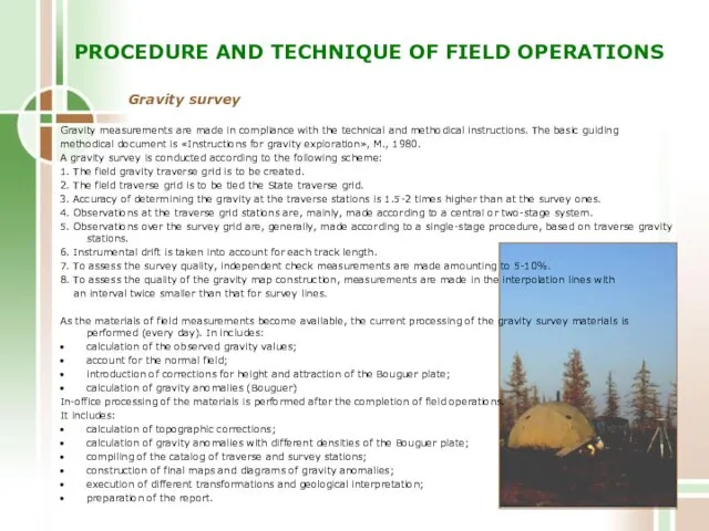
PROCEDURE AND TECHNIQUE OF FIELD OPERATIONS
Gravity survey
Gravity measurements are made in
PROCEDURE AND TECHNIQUE OF FIELD OPERATIONS
Gravity survey
Gravity measurements are made in
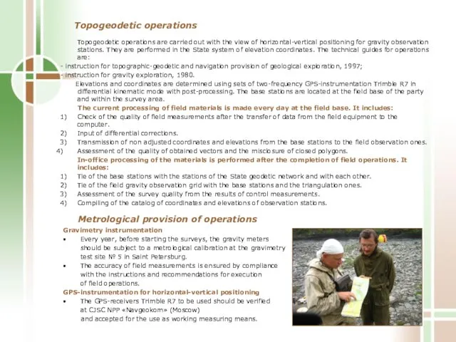
Topogeodetic operations are carried out with the view of horizontal-vertical positioning
Topogeodetic operations are carried out with the view of horizontal-vertical positioning
Staff of Gravity group
Valery V. Koshevoy – leading specialist, chief
Staff of Gravity group
Valery V. Koshevoy – leading specialist, chief
Staff of Gravity group
Tatyana V. Kuznetsova – leading engineer.
Staff of Gravity group
Tatyana V. Kuznetsova – leading engineer.
The following work was performed
by the gravity party
● over
The following work was performed
by the gravity party
● over
Examples of solving structural-mapping and geological prospecting problems from the results
Examples of solving structural-mapping and geological prospecting problems from the results
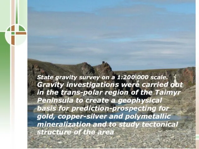
State gravity survey on a 1:200 000 scale.
Gravity investigations were carried
State gravity survey on a 1:200 000 scale.
Gravity investigations were carried
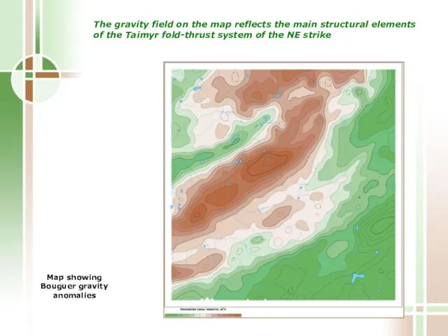
Map showing Bouguer gravity anomalies
The gravity field on the map
Map showing Bouguer gravity anomalies
The gravity field on the map
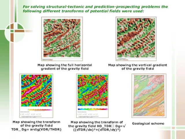
For solving structural-tectonic and prediction-prospecting problems the following different transforms of
For solving structural-tectonic and prediction-prospecting problems the following different transforms of
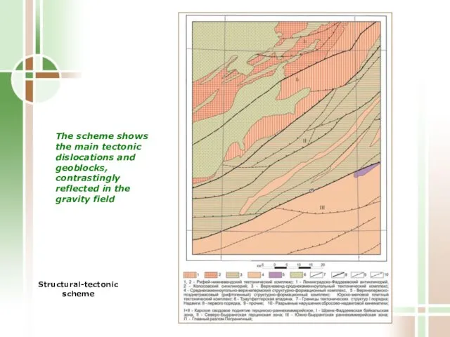
The scheme shows the main tectonic dislocations and geoblocks, contrastingly reflected
The scheme shows the main tectonic dislocations and geoblocks, contrastingly reflected
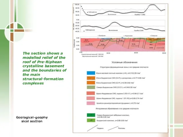
The section shows a modelled relief of the roof of Pre-Riphean
The section shows a modelled relief of the roof of Pre-Riphean
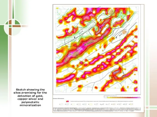
Sketch showing the sites promising for the detection of gold, copper-silver
Sketch showing the sites promising for the detection of gold, copper-silver
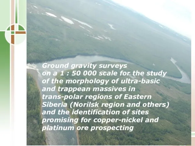
Ground gravity surveys
on a 1 : 50 000 scale for
Ground gravity surveys on a 1 : 50 000 scale for
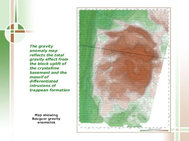
Map showing Bouguer gravity anomalies
The gravity anomaly map reflects the
Map showing Bouguer gravity anomalies
The gravity anomaly map reflects the
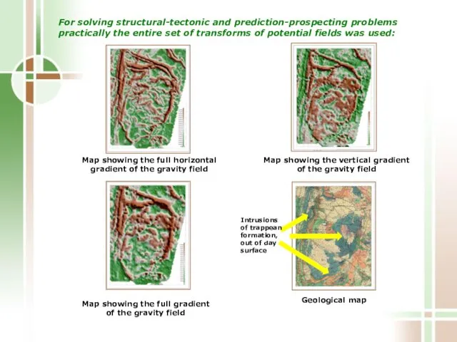
For solving structural-tectonic and prediction-prospecting problems practically the entire set of
For solving structural-tectonic and prediction-prospecting problems practically the entire set of
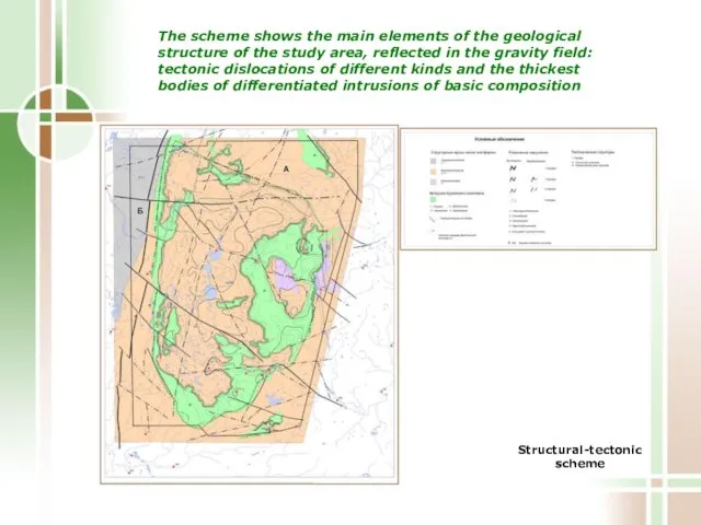
Structural-tectonic scheme
The scheme shows the main elements of the geological
Structural-tectonic scheme
The scheme shows the main elements of the geological
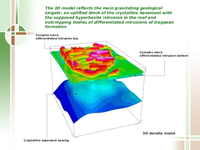
3D density model
The 3D model reflects the main gravitating geological
3D density model
The 3D model reflects the main gravitating geological
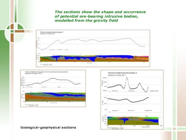
Geological-geophysical sections
The sections show the shape and occurrence
of potential
Geological-geophysical sections
The sections show the shape and occurrence of potential
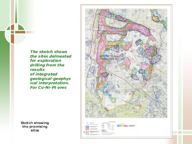
Sketch showing the promising sites
The sketch shows the sites delineated
Sketch showing the promising sites
The sketch shows the sites delineated
Salt tectonics mapping from the materials of gravity surveys on scales
Salt tectonics mapping from the materials of gravity surveys on scales
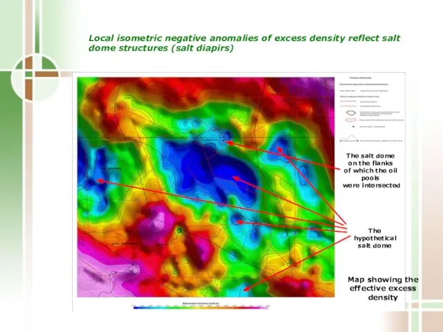
Local isometric negative anomalies of excess density reflect salt dome structures
Local isometric negative anomalies of excess density reflect salt dome structures
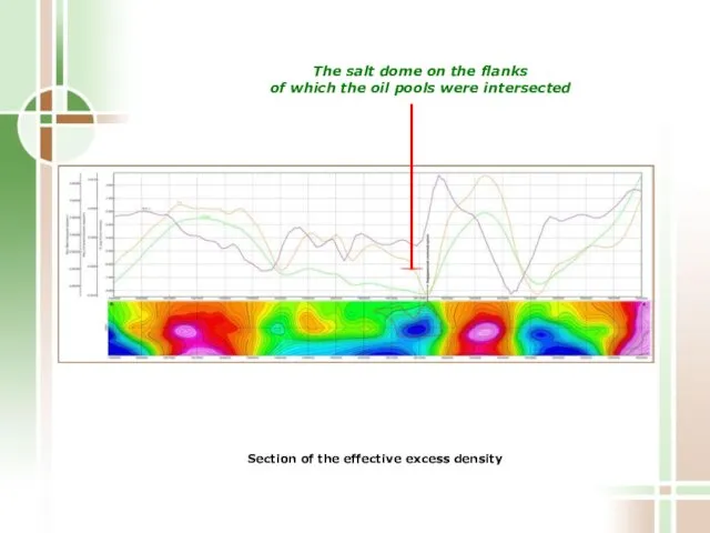
The salt dome on the flanks
of which the oil pools
The salt dome on the flanks
of which the oil pools
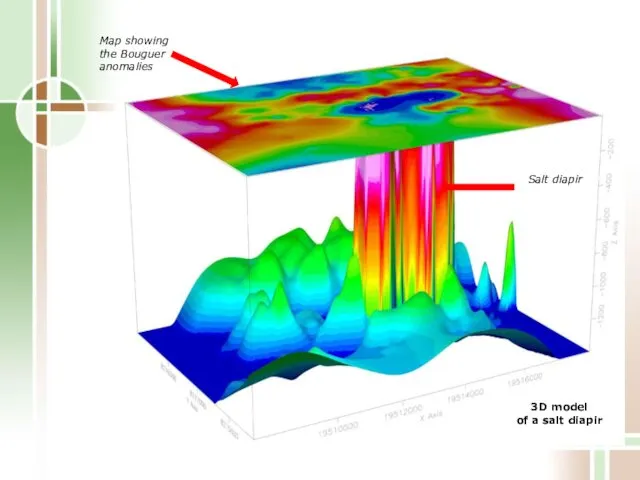
3D model
of a salt diapir
Map showing the Bouguer anomalies
3D model
of a salt diapir
Map showing the Bouguer anomalies
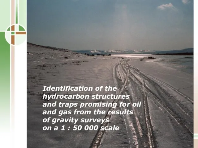
Identification of the hydrocarbon structures
and traps promising for oil and
Identification of the hydrocarbon structures and traps promising for oil and
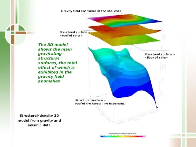
The 3D model shows the main gravitating structural surfaces, the total
The 3D model shows the main gravitating structural surfaces, the total
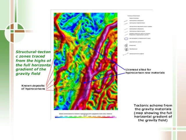
Structural-tectonic zones traced from the highs of the full horizontal gradient
Structural-tectonic zones traced from the highs of the full horizontal gradient
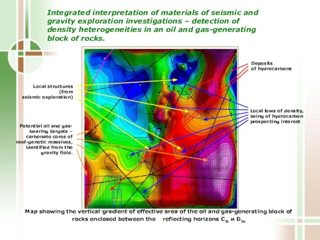
Integrated interpretation of materials of seismic and gravity exploration investigations –
Integrated interpretation of materials of seismic and gravity exploration investigations –
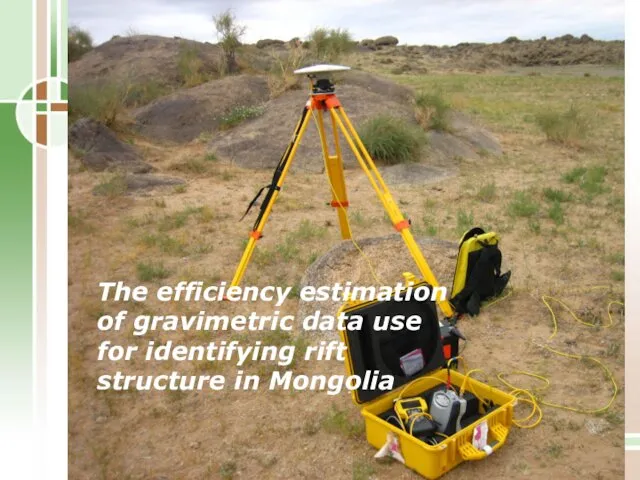
The efficiency estimation of gravimetric data use for identifying rift structure
The efficiency estimation of gravimetric data use for identifying rift structure
 El texto argumentativo: características y estructura
 СПБ ГБ ПОУ Охтинский колледж
 Традиционные и инновационные формы обучения, их особенности
 Практика для стоматологов в Турции. Сезон 2019
 Аттестационная работа. Школьная академия безопасности. Школа общения по телефону
 Принципы педагогической деятельности в работе с одаренными детьми
 Технологии дистанционного обучения
 Региональный центра коллективного проектирования СВЧ и фотонных ИС и модулей
 Использование образовательных платформ как средство повышения качества обучения
 Профессиональная деятельность
 Сибирский университет потребительской кооперации
 Факультет управления и права. Менеджмент. Менеджмент организации
 Отчет по внеучебной деятельности СТФ
 Учебные программы по предметам Математика 5-6 классы, Алгебра 7-9 классы и Геометрия 7-9 классы
 Стипендии: что делать во время карантина?
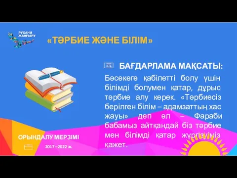 Тәрбие және білім. Орындалу мерзімі 2017 - 2022 ж. Бағдарлама мақсаты
 Система образования в Российской Федерации
 Государственная социальная политика
 Как работать над своим проектом
 Процедура проведения ГИА в ППЭ
 Российская международная академия туризма. Кафедра педагогики и психологии. Психолого-педагогическое образование
 Школьная форма
 Методические рекомендации по разработке дополнительных общеразвивающих программ
 Аттестационная работа. Исследовательская работа. Профессиональная карьера и её планирование
 Педагогический мониторинг для подготовки специалистов дошкольного образования. Качество образования
 Кафедра технологий производства и профессионального образования
 Аттестационная работа. Описание образовательной программы внеурочной деятельности В мире моего края
 Аттестационная работа. Методическая разработка по выполнению проектной работы Село Фатеево в числах